The Agriculture and Food Board warns about the spread of avian influenza. Please stay away from dead birds outdoors and ensure that your pets do not come into contact with them. NB! If you find a dead bird, do not touch it or move it anywhere! Please report it to the Agriculture and Food Board by calling 605 4767 or 1247.
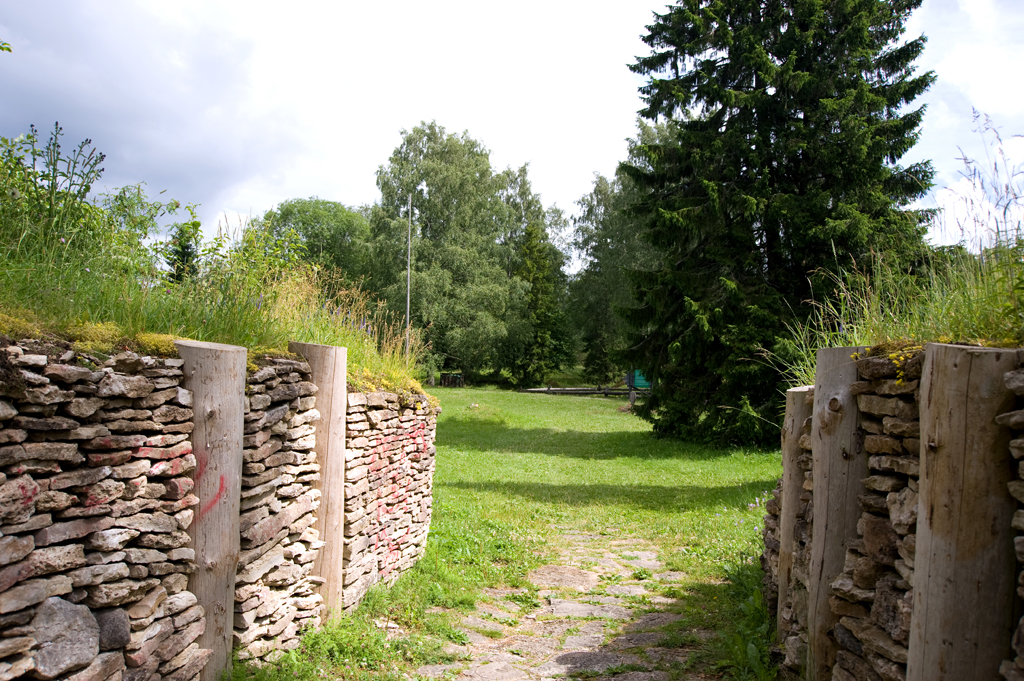
Varbola Stronghold is one of the largest ancient fortresses in Estonia. The yard, approximately 2 ha in size, is surrounded on all sides by a mainly limestone rampart supported by dry masonry and logs. The sides are covered by the debris caused by the collapse of the upper part. The total length of the rampart is 580 m. The height of the rampart on the outside is 7-10 m, on the inside it is 2-7 m.
The stronghold was used in the 12th and 14th centuries. In the 15th and 17th centuries, the stronghold’s yard was used as a cemetery. Numerous coins have been found since then, with most being sacrificial offerings.
Sights
Wall of the stronghold, stone-throwing catapult, siege tower, old well, oak stand
Amenities
2 campfire sites, 2 recreation sites with shelter, open-air stage with shelter, 80 benches, 3 information boards At the parking area there are 2 two-stall toilets, 2 information boards with general information and the layout map of the stronghold.
Varbola village,Märjamaa municipality, Rapla County
Navigation instructions : Drive 50 km
along the Tallinn-Pärnu road (Road no. 4), turn left towards Varbola. Drive
through the Varbola village 4 km up to
roadside signs. The stronghold is to the right of the road.
By clicking on the map it will open the map application larger in a new window.
Telephone:
+37 2676 7842
E-mail:
info.viimsi@rmk.ee
Object type:
other
Location info
Location:
Rapla County, Tallinn Recreation Area
Varbola village,Märjamaa municipality, Rapla County
Navigation instructions:
Drive 50 km
along the Tallinn-Pärnu road (Road no. 4), turn left towards Varbola. Drive
through the Varbola village 4 km up to
roadside signs. The stronghold is to the right of the road.