Lääne-Viru County, Aegviidu-Kõrvemaa Recreation Area
Campfire site by the RMK Penijõe-Aegviidu-Kauksi Hiking Route by the woodlot. Nearby is the Defense Forces heavy equipment transport road.
Hiking options
RMK Penijõe-Aegviidu-Kauksi Hiking Route
Camping
Maximum number of tents (for 4) allowed is 4.
Amenities
Outdoor fireplace, picnic table with shelter, 4 benches, firewood shelter, information board, DC, waste bin
Additional information
Parking not available. Before going on a nature walk please read the rules of conduct
Restrictions
Access only from the RMK Hiking Route.
Contact
Telephone: +372 604 7212
E-mail: info.aegviidu@rmk.ee
Object type: campfire site
Location info
Location : Lääne-Viru County, Aegviidu-Kõrvemaa Recreation Area
Tapa Municipality, Lääne-Viru County
Navigation instructions : By Tapa-Lehtse road, 3.4 km after the Tapa town border, turn left, coming from Lehtse after 5 km turn right, 300 m on the right side of the road.
Location : Harju County, Aegviidu-Kõrvemaa Recreation Area
Voose village, Harju County
Navigation instructions : Drive Jäneda-Alavere-Perla road 13 km, From Kreo bus stop turn left to the gravelled road, drive 700 until road branching: keep left, drive 2,5 km. Campfire site is on the left in a pine forest.
By clicking on the map it will open the map application larger in a new window.
Telephone:
+372 604 7212
E-mail:
info.aegviidu@rmk.ee
Object type:
campfire site
Location info
Location:
Harju County, Aegviidu-Kõrvemaa Recreation Area
Voose village, Harju County
Navigation instructions:
Drive Jäneda-Alavere-Perla road 13 km, From Kreo bus stop turn left to the gravelled road, drive 700 until road branching: keep left, drive 2,5 km. Campfire site is on the left in a pine forest.
Paukjärvi nature trail is circular: the trail starts and ends at the same point. If you take the left branch from the parking lot, the observation tower is 1 km away, and if you take the right branch, it is 4 km. The observation tower is located in Paukjärve esker – a ridge created under glacier. The tower offers a view of Põhja Kõrvemaa Nature Reserve. Kõnnu Suursoo is on one side, Paukjärv on the other.
Sights
View of Kõnnu Suursoo, bog lakes and pools and Lake Paukjärv on the other side.
Hiking options
Paukjärve nature trail
Camping
Paukjärve campsite
Amenities
11 m high wooden observation tower, 2 platforms
Parking
Parking for 20 cars or max 3 buses in Kaksiksilla parking area at the start of the trail
The tower is situated in North-Kõrvemaa nature reserve. Further information can be obtained from the Environmental Board +372 662 5999, info@keskkonnaamet.ee
Contact
Telephone: +372 604 7212
E-mail: info.aegviidu@rmk.ee
Object type: observation tower
Location info
Location : Harju County, Aegviidu-Kõrvemaa Recreation Area
Kuusalu municipality, Harju County
Navigation instructions : On Jägala–Käravete road
(Road no. 13), 29 km from Jägala, turn left to the gravel forest road, drive
7.2 km and turn right (follow the sign “Paukjärve”). Drive 2.2 km to
Kaksiksilla parking area, where the Paukjärve nature trail starts.
By clicking on the map it will open the map application larger in a new window.
Telephone:
+372 604 7212
E-mail:
info.aegviidu@rmk.ee
Object type:
observation tower
Location info
Location:
Harju County, Aegviidu-Kõrvemaa Recreation Area
Kuusalu municipality, Harju County
Navigation instructions:
On Jägala–Käravete road
(Road no. 13), 29 km from Jägala, turn left to the gravel forest road, drive
7.2 km and turn right (follow the sign “Paukjärve”). Drive 2.2 km to
Kaksiksilla parking area, where the Paukjärve nature trail starts.
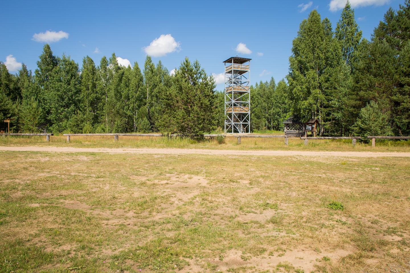
The observation tower is located in the Venemäe campsite. The tower offers a view of the surrounding forests and the Jussi moor. On the hill of Venemäe, at the location of the observation tower, there was a fire control point during the times of the Soviet army training ground.
Amenities
Metal observation tower, total height 19 m, observation platform at a height of 15.3 m
The tower is situated in North-Kõrvemaa nature reserve. Further information can be obtained from the Environmental Board +372 662 5999, info@keskkonnaamet.ee
Contact
Telephone: +372 604 7212
E-mail: info.aegviidu@rmk.ee
Object type: observation tower
Location info
Location : Harju County, Aegviidu-Kõrvemaa Recreation Area
Anija municipality, Harju County
Navigation instructions : Drive 31 km along
Jägala–Käravete road (Road no. 13), turn left onto gravel forest road and drive
3.5 km to the campsite parking area.
The observation tower is located on the territory of the Simisalu Nature House. The tower offers a good view of the surrounding landscapes and forests.
Sights
Kõrvemaa’s landscapes and nature.
Amenities
Metal observation tower, total height 19 m, observation platform at a height of 15.3 m
Location : Järva County, Aegviidu-Kõrvemaa Recreation Area
Vetepere village, Järva Municipality, Järva County
Navigation instructions : When coming from Tallinn, drive 7 km along Jäneda–Perila road
(Road no. 11125) and follow the sign “Albu” to the left. Drive 10 km along Lehtmetsa–Kaalepi
road (Road no. 15141) and turn right at Albu (follow the sign “Simisalu”).
Drive 2.2 km
and turn right (follow the sign “Simisalu”). Drive 5.8 km along the gravel road
to Simisalu Nature House. When coming from Paide, take Pärnu–Rakvere road (Road
no. 5) and 116 km
from Pärnu turn left (follow the sign “Järva-Madise”). Drive 5 km, turn left (follow the
sign “Simisalu”) and drive 7.5
km to Simisalu Nature House.
By clicking on the map it will open the map application larger in a new window.
Telephone:
+372 604 7212
E-mail:
info.aegviidu@rmk.ee
Object type:
observation tower
Location info
Location:
Järva County, Aegviidu-Kõrvemaa Recreation Area
Vetepere village, Järva Municipality, Järva County
Navigation instructions:
When coming from Tallinn, drive 7 km along Jäneda–Perila road
(Road no. 11125) and follow the sign “Albu” to the left. Drive 10 km along Lehtmetsa–Kaalepi
road (Road no. 15141) and turn right at Albu (follow the sign “Simisalu”).
Drive 2.2 km
and turn right (follow the sign “Simisalu”). Drive 5.8 km along the gravel road
to Simisalu Nature House. When coming from Paide, take Pärnu–Rakvere road (Road
no. 5) and 116 km
from Pärnu turn left (follow the sign “Järva-Madise”). Drive 5 km, turn left (follow the
sign “Simisalu”) and drive 7.5
km to Simisalu Nature House.
The observation tower is located on the Järvi-Aegviidu hiking trail in the middle of Kõnnu Suursoo - it translates into English as Kõnnu Big Bog. To visit the observation tower, follow the left branch of the Paukjärve nature trail for 1 km from the Kaksiksilla parking lot to the Pauljärve esker. There the nature trail crosses the Järvi-Aegviidu hiking trail. Turn left to Kõnnu Suursoo and after 1.2 km you will reach the observation tower. The tower offers a view of the bog landscape and pools.
Sights
View of Kõnnu Suursoo, bog lakes and pools
Amenities
10 m high wooden observation tower, 2 platforms
Parking
At Kaksiksilla parking area for 20 cars or 4 buses.
The observation tower is situated in North-Kõrvemaa nature reserve. Further information can be obtained from the Environmental Board +372 662 5999, info@keskkonnaamet.ee
Contact
Telephone: +372 604 7212
E-mail: info.aegviidu@rmk.ee
Object type: observation tower
Location info
Location : Harju County, Aegviidu-Kõrvemaa Recreation Area
Kuusalu municipality, Harju County Anija municipality, Harju County
Navigation instructions : On the 56.km of Tallinn-Narva road (road no.1) turn right in direction "Kemba", drive 0,9 km and turn right in direction "Järvi järved". Drive 4 km along the gravelled road to reach the camping area`s parking lot.
By clicking on the map it will open the map application larger in a new window.
Telephone:
+372 604 7212
E-mail:
info.aegviidu@rmk.ee
Object type:
observation tower
Location info
Location:
Harju County, Aegviidu-Kõrvemaa Recreation Area
Kuusalu municipality, Harju County Anija municipality, Harju County
Navigation instructions:
On the 56.km of Tallinn-Narva road (road no.1) turn right in direction "Kemba", drive 0,9 km and turn right in direction "Järvi järved". Drive 4 km along the gravelled road to reach the camping area`s parking lot.
Nice simple campfire site at Lake Rava, at the edge of an oak stand. On the opposite side of the lake one can find a sandy bathing place.
Sights
Rava Manor, Rava oak stand. Rava oak stand in the former manor park was placed under protection in 1936 to save the species-rich mixed oak stand from cutting. It was the first entry in the nature conservation registry of the Republic of Estonia.
Hiking options
Located on Peraküla-Aegviidu-Ähijärve hiking route.
Camping
Maximum number of tents (for 4) allowed is 4.
Amenities
Fire ring with grill, table and benches, firewood shelter, dry toilet, waste bin
Water
Non-potable water from Lake Rava
Parking
Up to 10 cars or 2 buses, distance to the campfire site 400 m
Location : Järva County, Aegviidu-Kõrvemaa Recreation Area
Järva municipality, Järva County
Navigation instructions : When coming from Tallinn: Take the Piibe road up to Aravete. 200 m before the turn towards Tartu, the sign "Rava 5" points to the left. Drive 5 km along the secondary road to Rava village. The artificial lake and Rava campfire site are to the left of the road.
By clicking on the map it will open the map application larger in a new window.
Telephone:
+372 604 7212
E-mail:
info.aegviidu@rmk.ee
Object type:
campfire site
Location info
Location:
Järva County, Aegviidu-Kõrvemaa Recreation Area
Järva municipality, Järva County
Navigation instructions:
When coming from Tallinn: Take the Piibe road up to Aravete. 200 m before the turn towards Tartu, the sign "Rava 5" points to the left. Drive 5 km along the secondary road to Rava village. The artificial lake and Rava campfire site are to the left of the road.
A simple campfire site at the former Tamme forest keeper's farmstead.
Sights
Ruins of Tamme forest keeper's farm
Hiking options
Located by Peraküla-Aegviidu-Ähijärve hiking route
Camping
Maximum number of tents (for 4) allowed is 4
Amenities
Fire ring with grill, shelter with table and benches, benches, dry toilet, waste bin, firewood shelter
Parking
Parking for 4 cars
Additional information
No water near the campfire site. Before going on a nature walk please read the rules of conduct
Contact
Telephone: +372 604 7212
E-mail: info.aegviidu@rmk.ee
Object type: campfire site
Location info
Location : Järva County, Aegviidu-Kõrvemaa Recreation Area
Järva municipality, Järva County
Navigation instructions : When coming from Tallinn: Take the Piibe road up to Järva-Jaani. From Järva-Jaani drive 3.5 km along Piibe road towards Tartu, until a small earth road turns to the left. Follow that road, you will get to Tamme campfire site after about 100 metres.
By clicking on the map it will open the map application larger in a new window.
Telephone:
+372 604 7212
E-mail:
info.aegviidu@rmk.ee
Object type:
campfire site
Location info
Location:
Järva County, Aegviidu-Kõrvemaa Recreation Area
Järva municipality, Järva County
Navigation instructions:
When coming from Tallinn: Take the Piibe road up to Järva-Jaani. From Järva-Jaani drive 3.5 km along Piibe road towards Tartu, until a small earth road turns to the left. Follow that road, you will get to Tamme campfire site after about 100 metres.
RMK hiking route Peraküla-Aegviidu-Ähijärve / Alavere – Aegviidu (32 km)
VõimalusedHiking trail/Hiking OptionsCampingFireplaceCovered fireplaceMaintenance during summerParking
Harju County, Aegviidu-Kõrvemaa Recreation Area
In this section, the hiking route reaches the forests of Kõrvemaa area. In Alavere there is a shop where food supplies can be restocked. Also the Jägala and Jänijõgi rivers are along the route. The end point of this section is at Aegviidu Visitor Centre.
Amenities
The trail is marked with signposts and white-green-white paint markings. The rest stops on the trail and distances between them:
Alavere campfire site - Krani campfire site 21,5 km
Krani campfire site - Aegviidu Visitor Centre 10,5 km
Water
Non-potable water can be taken from the Liivoja stream; drinking water is available at Aegviidu Visitor Centre.
Parking
Aegviidu Visitor Centre is suitable for long-term parking. Parking for 2-3 cars is available at each campfire site.
RMK hiking route Peraküla-Aegviidu-Ähijärve / Aegviidu-Oostriku (107 km)
VõimalusedHiking trail/Hiking OptionsCampingFireplaceMaintenance during summerParking
Järva County, Aegviidu-Kõrvemaa Recreation Area
This part of the route starts from the yard of Aegviidu Visitor Centre and meanders its first 30 kilometres in the same track with the Oandu-Ikla hiking route. On Matsimäe esker, the trails branch at the hiking hotel "Rabav", where the Ähijärve direction turns south. The trail goes over the Seli bog to Simisalu, thereafter to Vargamäe and then over the Kodru bog to Järva-Madise. Here the classic nature hiking ends for some time, as the trail winds through Järva county mainly along roads that are mostly lined with fields and grasslands. Among larger places on the trail there are Järva-Madise, Aravete, Järva-Jaani and Koeru, where hikers can restock their supplies, enjoy civilization or even end or start their journey. The route runs through Koeru along its main street and then, outside the borough, goes towards the Norra springs area. The trail goes along a gravel road to the western part of the Endla Nature Reserve.
Amenities
The trail is marked with signposts and white-green-white paint markings. The rest stops on the trail and distances between them:
Aegviidu Visitor Centre - Nikerjärve campsite 2 km
Nikerjärve campsite - Mägede campfire sites 7 km
Mägede campfire sites -Noku campfire site 10 km
Noku campfire site - Napu campfire site 8 km
Napu campfire site - Matsimäe quarry campfire site 12 km
Matsimäe quarry campfire site - Simisalu campfire site 8 km
Simisalu campfire site - Kurisoo campfire site 15 km/li>
Kurisoo campfire site - Rava campfire site 5 km
Rava campfire site - Tamme campfire site 17 km
Tamme campfire site - Oostriku campfire site 23 km
Water
Drinking water is available from Aegviidu Visitor Centre during its opening hours, from the well at Simisalu Nature House. Non-potable water can be taken from the lake at Matsimäe quarry, the Jägala river, Lake Rava.
Parking
Aegviidu Visitor Centre is suitable for long-term parking. Parking for 2-3 cars is available at each campfire site.
The restrictions of Kõrvemaa Landscape Reserve must be observed. All along the hiking route one should not forget that camping and making a fire is allowed only at places prepared for those purposes.
Contact
Telephone: +372 604 7212
E-mail: info.aegviidu@rmk.ee
Object type: hiking route
Location info
Location : Järva County, Aegviidu-Kõrvemaa Recreation Area