Where to go
The tallest Douglas fir in Estonia

The tallest Douglas fir in Estonia


Võimalused

Valga County
Attention!

Foot-and-mouth, a severe animal disease, is currently circulating in Europe and also poses a threat to animals in Estonia. Your help is needed to prevent animals here – sheep, cattle, goats, and other ungulates – from becoming infected. We ask that you please follow some important recommendations.

Read them here!

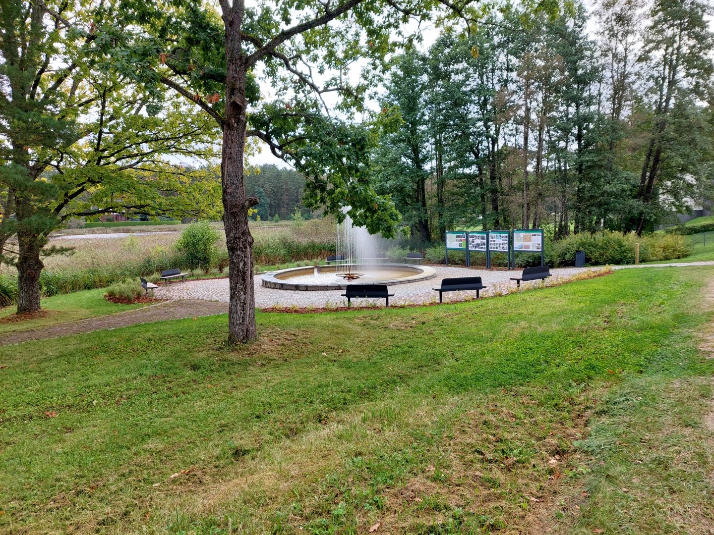
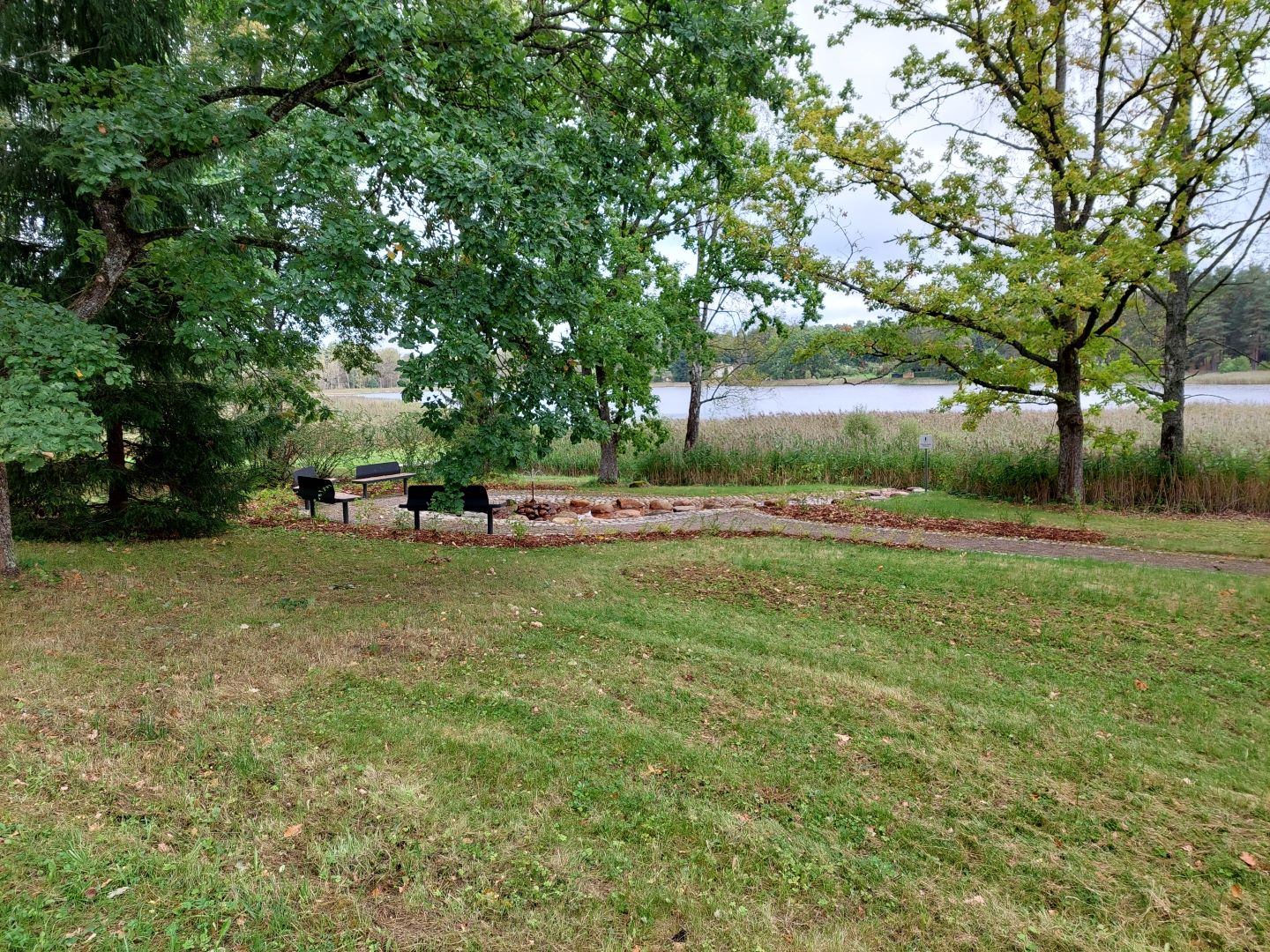
Estonia’s tallest Douglas fir is most likely growing in the state forest near RMK’s Tellingumäe observation tower and campfire site, along with other similar Douglas firs, larches, and pines. The tower offers a good view of the magnificent trees.
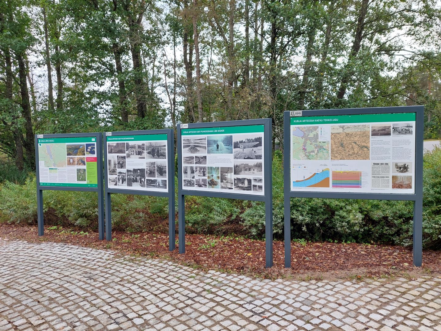
In 2023, RMK and the employees of the Estonian University of Life Sciences measured the trees with the help of a ground-based laser scanner, and it turned out that one of them reaches a height of 44 metres. This tree is marked with an information board.
Growing in the same group as the Douglas firs on Tellingumägi are pines and larches of an honourable age. Like the Douglas firs, they are nearly 140 years old (estimated to begun growing in 1886).


The trees grow on the forest land of the former Taheva Manor. It is not known how these trees found their way into the soil 140 years ago, but at that time Taheva Manor was owned by Maximilian von Wulf, who was also the last owner of the manor.
Forty-four metres is an impressive height for a tree; however, a Douglas fir can also grow to nearly 100 metres in height. As a species, the Douglas fir is alien to Estonia. The homeland of the tree is North America and Asia.


The wood of the Douglas fir is strong, mainly used in construction. In Estonia, Douglas firs mostly grow in green areas.
In his Estonian language book Mõtsa ja Tagasi, Jaan Kaplinski has suggested that the Douglas fir could be called ‘tuglas’. ‘I think that it is best to call it the ‘tuglas’, the older name was Douglasia.’

Parking

Parking for 10 cars in the Bike path campfire site parking lot

Amenities

The tree is marked with an information board

Additional Information

Before going on a nature walk please read the Environmental code of conduct, rules of conduct and waste-sorting policy

Contact

Telephone: +372 501 9564

E-mail: info.pahni@rmk.ee

Object type: rest stop

Location info

Location : Valga County

Laanemetsa village, Valga municipality, Valga county

Coordinates:

Long-Lat WGS 84
Latitude: 57.600484
Longitude: 26.333603
L-EST 97x: 6386664.01
L-EST 97y: 639512.57

Telephone:
+372 501 9564
E-mail:
info.pahni@rmk.ee
Object type:
rest stop
Location info
Location:
Valga County
Laanemetsa village, Valga municipality, Valga county
Coordinates:

Long-Lat WGS 84
Latitude: 57.600484
Longitude: 26.333603
L-EST 97x: 6386664.01
L-EST 97y: 639512.57

Where to go
The highest aspen in Estonia

The highest aspen in Estonia


Võimalused

Valga County, Haanja-Karula Recreation Area
Attention!

Foot-and-mouth, a severe animal disease, is currently circulating in Europe and also poses a threat to animals in Estonia. Your help is needed to prevent animals here – sheep, cattle, goats, and other ungulates – from becoming infected. We ask that you please follow some important recommendations.

Read them here!

The tallest known aspen in Estonia (Populus tremula) has a height of 43.2 metres. The aspens growing next to it also have a height exceeding 43 meters. The exceptional height of the aspen was revealed by analysing remote sensing data, after which RMK employees and researchers from the Estonian University of Life Sciences also measured the tree with an electron tachymeter.
The diameter of the tree at chest height was measured to be 49.4 cm in 2021. The age of the tree was estimated to be 93 years, based on the growth rings from the core sample collected in the same year. Until 2021, the 41.6-metre-tall aspen tree growing in the Järvselja Forest District, in Tartu County, was believed to be the tallest aspen in Estonia. The area is famous for the activities of Count Friedrich Georg Magnus Berg (16 February 1845-22 March 1938). He paid special attention to oaks, with oak alleys located only a few hundred metres from here. Whether Count Berg’s hand was at work with the birth of this aspen tree is unknown.


Parking

by the road

Amenities

The tree is marked with an information board

Additional Information

Before going on a nature walk please read the Environmental code of conduct, rules of conduct and waste-sorting policy

Contact

Telephone: +372 501 9564

E-mail: info.pahni@rmk.ee

Object type: rest stop

Location info

Location : Valga County, Haanja-Karula Recreation Area

Tiidu village, Otepää municipality, Valga county

Coordinates:

Long-Lat WGS 84
Latitude: 57.935479
Longitude: 26.238892
L-EST 97x: 6423761
L-EST 97y: 632607

Telephone:
+372 501 9564
E-mail:
info.pahni@rmk.ee
Object type:
rest stop
Location info
Location:
Valga County, Haanja-Karula Recreation Area
Tiidu village, Otepää municipality, Valga county
Coordinates:

Long-Lat WGS 84
Latitude: 57.935479
Longitude: 26.238892
L-EST 97x: 6423761
L-EST 97y: 632607

Where to go
Metsavenna campfire site Võrumaa

Metsavenna campfire site Võrumaa


Võimalused

Matkarada/Matkavõimalus
Telkimine
Telkimine
Lõkkekoht
Lõkkekoht
Maintenance during summer
Parkimine
Parkimine
Võru County, Haanja-Karula Recreation Area
Attention!

Foot-and-mouth, a severe animal disease, is currently circulating in Europe and also poses a threat to animals in Estonia. Your help is needed to prevent animals here – sheep, cattle, goats, and other ungulates – from becoming infected. We ask that you please follow some important recommendations.

Read them here!

This campfire site was designed primarily as a rest stop for hikers on RMK Peraküla-Aegviidu-Ähijärve hiking route.

Parking

Parking near the campfire site.

Water

Water is available from the Vaidva river.

Amenities

Fire ring, table and benches, dry toilet

Hiking Options

Hiking on the RMK Peraküla-Aegviidu-Ähijärve Hiking Route. 600 m from the site is the start of Mõisamõtsa nature trail.

Camping

Maximum number of tents (for 4) allowed is 5.

Sights

Vaidva river, Metsavenna farm, watermill of Vastse-Roosa manor

Additional Information

The campfire site is located in private land, so please show respect to the landowners.
From Metsavenna Farm it is possible to book different services and study the history of partisans (Forest Brothers). Near the campfire site you can also find the Metsavenna shop.
Before going on a nature walk please read the Environmental code of conduct (freedom to roam), rules of conduct and waste-sorting policy

Contact

Telephone: +372 501 9564

E-mail: info.pahni@rmk.ee

Object type: campfire site

Location info

Location : Võru County, Haanja-Karula Recreation Area

Vastse-Roosa village, Rõuge municipality, Võru County

Navigation instructions : On Võru-Valga Road (road no. 67), 37 km from Võru, turn left at Mõniste intersection (when coming from Valga, 44 km and turn right, follow the sign "Ape, Mõniste"). Drive 6.5 km and turn left after the Vaidva river bridge and Mehka intersection. The campfire site is on the right, just before the mill dam.

Coordinates:

Long-Lat WGS 84
Latitude: 57.571917
Longitude: 26.663647
L-EST 97x: 6384219
L-EST 97y: 659360

Telephone:
+372 501 9564
E-mail:
info.pahni@rmk.ee
Object type:
campfire site
Location info
Location:
Võru County, Haanja-Karula Recreation Area
Vastse-Roosa village, Rõuge municipality, Võru County
Navigation instructions:
On Võru-Valga Road (road no. 67), 37 km from Võru, turn left at Mõniste intersection (when coming from Valga, 44 km and turn right, follow the sign "Ape, Mõniste"). Drive 6.5 km and turn left after the Vaidva river bridge and Mehka intersection. The campfire site is on the right, just before the mill dam.
Coordinates:

Long-Lat WGS 84
Latitude: 57.571917
Longitude: 26.663647
L-EST 97x: 6384219
L-EST 97y: 659360

Where to go
Luhasoo campfire site

Luhasoo campfire site


Võimalused

Matkarada/Matkavõimalus
Telkimine
Telkimine
Lõkkekoht
Lõkkekoht
Aastaringi hooldus
Aastaringi hooldus
Parkimine
Parkimine
Võru County, Haanja-Karula Recreation Area
Attention!

Foot-and-mouth, a severe animal disease, is currently circulating in Europe and also poses a threat to animals in Estonia. Your help is needed to prevent animals here – sheep, cattle, goats, and other ungulates – from becoming infected. We ask that you please follow some important recommendations.

Read them here!

A campfire site located at the beginning of the Luhasoo study trail, where you can stop and enjoy a picnic. The popular five-kilometre study trail leads to a bog lake with swimming bridges and a mineral island, where a pleasant forest hut is located, and eventually brings you back to the Luhasoo campfire site.

Parking

Parking for 10 cars.

Water

No water near the site.

Amenities

Benches, table, fire ring, firewood shed, information board introducing the landscape protection area, dry toilet, waste bin

Hiking Options

Luhasoo study trail starts near the campfire site.

Camping

Maximum number of tents (for 4) allowed is 2.

Additional Information

  • Hikers in the hiking route who want to find shelter in rainy weather should go 2.5 km along Luhasoo study trail to Meiesaare. On that bog island you can find a forest hut with bunks and a fireplace inside. To make fire, take firewood with you from the firewood shelter at the start of the boardwalk.
  • The object is equipped with firewood.
  • Before going on a nature walk please read the Environmental code of conduct (freedom to roam), rules of conduct and waste-sorting policy

Restrictions

The campfire site is located in private land within Luhasoo Landscape Protection Area. Further information can be obtained from the Environmental Board +372 662 5999, info@keskkonnaamet.ee

Contact

Telephone: +372 501 9564

E-mail: info.pahni@rmk.ee

Object type: campfire site

Location info

Location : Võru County, Haanja-Karula Recreation Area

Rõuge municipality, Võru County

Navigation instructions : Drive 22 km along Võru-Rõuge-Vastse-Roosa Road and turn left after Pärlijõe bus stop (follow the sign "Luhasoo maastikukaitseala") and after 4.4 km again to the left (follow the sign "Luhasoo õpperada"). After 400 m turn right into the parking area of Luhasoo study trail. The campfire site is next to the parking area.

Coordinates:

Long-Lat WGS 84
Latitude: 57.640641
Longitude: 26.887905
L-EST 97x: 672431.9
L-EST 97y: 6392420.7

Telephone:
+372 501 9564
E-mail:
info.pahni@rmk.ee
Object type:
campfire site
Location info
Location:
Võru County, Haanja-Karula Recreation Area
Rõuge municipality, Võru County
Navigation instructions:
Drive 22 km along Võru-Rõuge-Vastse-Roosa Road and turn left after Pärlijõe bus stop (follow the sign "Luhasoo maastikukaitseala") and after 4.4 km again to the left (follow the sign "Luhasoo õpperada"). After 400 m turn right into the parking area of Luhasoo study trail. The campfire site is next to the parking area.
Coordinates:

Long-Lat WGS 84
Latitude: 57.640641
Longitude: 26.887905
L-EST 97x: 672431.9
L-EST 97y: 6392420.7

Where to go
Paganamaa campfire site

Paganamaa campfire site


Võimalused

Matkarada/Matkavõimalus
Telkimine
Telkimine
Lõkkekoht
Lõkkekoht
Aastaringi hooldus
Aastaringi hooldus
Võru County, Haanja-Karula Recreation Area
Attention!

Foot-and-mouth, a severe animal disease, is currently circulating in Europe and also poses a threat to animals in Estonia. Your help is needed to prevent animals here – sheep, cattle, goats, and other ungulates – from becoming infected. We ask that you please follow some important recommendations.

Read them here!

The campfire site on the bank of the valley is a wonderful and exciting place. This area is teeming with stories and legends, all related with Vanapagan (The Old Heathen) and his activities. From the tower on Raadi Hill you can have a view at the wonderful landscape of Paganamaa and the Latvian woods on the other side of the lake chain.
Parking

Parking in private land for 10 cars.

Water

Non-potable water is available from Lake Liivajärv.

Amenities

Fire ring, table and benches, conical tent, dry toilet, information board introducing the protected area

Hiking Options

Hiking on Paganamaa study trails and RMK Peraküla-Aegviidu-Ähijärve hiking route.

Camping

Maximum number of tents (for 4) allowed is 10.

Sights

Piiriorg valley, chain of lakes, landscape, Raadimägi hill

Additional Information

Restrictions

The campfire site is located in Paganamaa Landscape Protection Area. Further information can be obtained from the Environmental Board +372 662 5999, info@keskkonnaamet.ee

Contact

Telephone: +372 501 9564

E-mail: info.pahni@rmk.ee

Object type: campfire site

Location info

Location : Võru County, Haanja-Karula Recreation Area

Paganamaa, Rõuge municipality, Võru County.

Navigation instructions : On Võru–Rõuge–Vastse-Roosa road, 32 km from Võru (1.5 km from the centre of Krabi) turn left (follow the signs “Paganamaa vaatetorn”, “Paganamaa matkarajad”). Drive 2.2 km to the parking area at the bank of Piiriorg valley.

Coordinates:

Long-Lat WGS 84
Latitude: 57.585316
Longitude: 26.834391
L-EST 97x: 669494.0
L-EST 97y: 6386119.9

Telephone:
+372 501 9564
E-mail:
info.pahni@rmk.ee
Object type:
campfire site
Location info
Location:
Võru County, Haanja-Karula Recreation Area
Paganamaa, Rõuge municipality, Võru County.
Navigation instructions:
On Võru–Rõuge–Vastse-Roosa road, 32 km from Võru (1.5 km from the centre of Krabi) turn left (follow the signs “Paganamaa vaatetorn”, “Paganamaa matkarajad”). Drive 2.2 km to the parking area at the bank of Piiriorg valley.
Coordinates:

Long-Lat WGS 84
Latitude: 57.585316
Longitude: 26.834391
L-EST 97x: 669494.0
L-EST 97y: 6386119.9

Where to go
Paganamaa observation tower

Paganamaa observation tower


Võimalused

Matkarada/Matkavõimalus
Telkimine
Telkimine
Vaatetorn
Vaatetorn
Lõkkekoht
Lõkkekoht
Aastaringi hooldus
Aastaringi hooldus
Võru County, Haanja-Karula Recreation Area
Attention!

Foot-and-mouth, a severe animal disease, is currently circulating in Europe and also poses a threat to animals in Estonia. Your help is needed to prevent animals here – sheep, cattle, goats, and other ungulates – from becoming infected. We ask that you please follow some important recommendations.

Read them here!

From the observation tower on Raadi hill you can see the amazing landscape of the Paganamaa area and the forests of Latvia on the other side of the chain of lakes.
Parking

Parking for 10 cars at the campfire site Paganamaa.

Amenities

Wooden tower

Hiking Options

Hiking on Paganamaa study trails and RMK Peraküla-Aegviidu-Ähijärve hiking route.

Camping

Paganamaa campfire site.

Outdoor Fireplace

Fire ring with a grill in Paganamaa campfire site.

Sights

Piiriorg valley, chain of lakes, landscape, Raadimägi hill

Additional Information

Before going on a nature walk please read the Environmental code of conduct (freedom to roam), rules of conduct and waste-sorting policy

Restrictions

The observation tower is located in Paganamaa Landscape Protection Area. Further information can be obtained from the Environmental Board +372 662 5999, info@keskkonnaamet.ee

Contact

Telephone: +372 501 9564

E-mail: info.pahni@rmk.ee

Object type: observation tower

Location info

Location : Võru County, Haanja-Karula Recreation Area

Paganamaa, Rõuge municipality, Võru County.

Navigation instructions : On Võru–Rõuge–Vastse-Roosa road, 32 km from Võru (1.5 km from the centre of Krabi) turn left (follow the signs “Paganamaa vaatetorn”, “Paganamaa matkarajad”). Drive 2.2 km to the parking area at the bank of Piiriorg valley.

Coordinates:

Long-Lat WGS 84
Latitude: 57.587
Longitude: 26.837332
L-EST 97x: 669671.5
L-EST 97y: 6386326.3

Telephone:
+372 501 9564
E-mail:
info.pahni@rmk.ee
Object type:
observation tower
Location info
Location:
Võru County, Haanja-Karula Recreation Area
Paganamaa, Rõuge municipality, Võru County.
Navigation instructions:
On Võru–Rõuge–Vastse-Roosa road, 32 km from Võru (1.5 km from the centre of Krabi) turn left (follow the signs “Paganamaa vaatetorn”, “Paganamaa matkarajad”). Drive 2.2 km to the parking area at the bank of Piiriorg valley.
Coordinates:

Long-Lat WGS 84
Latitude: 57.587
Longitude: 26.837332
L-EST 97x: 669671.5
L-EST 97y: 6386326.3

Where to go
Verijärve rest stop
Verijärve rest stop
Verijärve rest stop
Verijärve rest stop

Verijärve rest stop


Võimalused

Matkarada/Matkavõimalus
Puhkekoht
Puhkekoht
Wheelchair Accessibility
Parkimine
Parkimine
Võru County, Haanja-Karula Recreation Area
Attention!

Foot-and-mouth, a severe animal disease, is currently circulating in Europe and also poses a threat to animals in Estonia. Your help is needed to prevent animals here – sheep, cattle, goats, and other ungulates – from becoming infected. We ask that you please follow some important recommendations.

Read them here!

A parking lot and information site introducing the protected areas of Võru County with the maps of the protected areas and hiking trails in the county.
Parking

Parking area for 15 cars.

Amenities

Information boards introducing the protected areas and hiking trails of Võru county, table and benches, dry toilet

Wheelchair Accessibility

yes

Hiking Options

Nearby is the Verijärve hiking trail.

Sights

Dry mixed forests, Lake Verijärv

Additional Information

Before going on a nature walk please read the Environmental code of conduct, rules of conduct and waste-sorting policy

Contact

Telephone: +372 501 9564

E-mail: info.pahni@rmk.ee

Object type: rest stop

Location info

Location : Võru County, Haanja-Karula Recreation Area

Kose, Võru municipality, Võru County

Navigation instructions : Take Võru-Luhamaa Road (road no. 2) and drive 2.2 km from Võru to Aiandi bus stop. After the bus stop there is a parking area on the right side of the road with information boards introducing the protected areas of Võru County.

Coordinates:

Long-Lat WGS 84
Latitude: 57.810799
Longitude: 27.056091
L-EST 97x: 681612.7
L-EST 97y: 6411799.9

Telephone:
+372 501 9564
E-mail:
info.pahni@rmk.ee
Object type:
rest stop
Location info
Location:
Võru County, Haanja-Karula Recreation Area
Kose, Võru municipality, Võru County
Navigation instructions:
Take Võru-Luhamaa Road (road no. 2) and drive 2.2 km from Võru to Aiandi bus stop. After the bus stop there is a parking area on the right side of the road with information boards introducing the protected areas of Võru County.
Coordinates:

Long-Lat WGS 84
Latitude: 57.810799
Longitude: 27.056091
L-EST 97x: 681612.7
L-EST 97y: 6411799.9

Where to go
Kubja rest stop

Kubja rest stop


Võimalused

Puhkekoht
Puhkekoht
Maintenance during summer
Võru County, Haanja-Karula Recreation Area
Attention!

Foot-and-mouth, a severe animal disease, is currently circulating in Europe and also poses a threat to animals in Estonia. Your help is needed to prevent animals here – sheep, cattle, goats, and other ungulates – from becoming infected. We ask that you please follow some important recommendations.

Read them here!

The rest stop is on the shore of Lake Kubija. The main attraction here is an artesian well, from which water flows under natural pressure to the ground.
Amenities

Artesian well, benches

Sights

Lake Kubija, artesian well

Additional Information

Before going on a nature walk please read the Environmental code of conduct, rules of conduct and waste-sorting policy

Contact

Telephone: +372 501 9564

E-mail: info.pahni@rmk.ee

Object type: rest stop

Location info

Location : Võru County, Haanja-Karula Recreation Area

Meegomäe, Võru municipality, Võru County

Coordinates:

Long-Lat WGS 84
Latitude: 57.81312
Longitude: 26.99880
L-EST 97x: 678190.3
L-EST 97y: 6411911.9

Telephone:
+372 501 9564
E-mail:
info.pahni@rmk.ee
Object type:
rest stop
Location info
Location:
Võru County, Haanja-Karula Recreation Area
Meegomäe, Võru municipality, Võru County
Coordinates:

Long-Lat WGS 84
Latitude: 57.81312
Longitude: 26.99880
L-EST 97x: 678190.3
L-EST 97y: 6411911.9

Where to go
Lõunatipu campfire site

Lõunatipu campfire site


Võimalused

Matkarada/Matkavõimalus
Metsaonn
Metsaonn
Telkimine
Telkimine
Lõkkekoht
Lõkkekoht
Maintenance during summer
Võru County, Haanja-Karula Recreation Area
Attention!

Foot-and-mouth, a severe animal disease, is currently circulating in Europe and also poses a threat to animals in Estonia. Your help is needed to prevent animals here – sheep, cattle, goats, and other ungulates – from becoming infected. We ask that you please follow some important recommendations.

Read them here!

Parking

Parking for 2 cars on private land in Naha Village under the oak-tree.

Water

Water can be taken from the Peetri river.

Amenities

Fireplace, firewood shelter, table and benches, forest hut, dry toilet. The forest hut has no heating.

Hiking Options

The campfire site is on the Peraküla-Aegviidu-Ähijärve hiking route.

Camping

Maximum number of tents (for 4) allowed is 2.

Berries-mushrooms

Bilberries, mushrooms.

Additional Information

Before going on a nature walk please read the Environmental code of conduct (freedom to roam), rules of conduct and waste-sorting policy

Contact

Telephone: +372 501 9564

E-mail: info.pahni@rmk.ee

Object type: campfire site

Location info

Location : Võru County, Haanja-Karula Recreation Area

Karisöödi village, Rõuge municipality, Võru County.

Navigation instructions : From Saru village on Võru-Valga Road, drive towards Kuutsi, then follow the route Tiitsa–Karisöödi–Ura–Naha. Park at the oak-tree at Naha farm and walk along Lõunatipu study trail until you arrive at the campfire site.

Coordinates:

Long-Lat WGS 84
Latitude: 57.509518
Longitude: 26.616666
L-EST 97x: 656828.1
L-EST 97y: 6377172.1

Telephone:
+372 501 9564
E-mail:
info.pahni@rmk.ee
Object type:
campfire site
Location info
Location:
Võru County, Haanja-Karula Recreation Area
Karisöödi village, Rõuge municipality, Võru County.
Navigation instructions:
From Saru village on Võru-Valga Road, drive towards Kuutsi, then follow the route Tiitsa–Karisöödi–Ura–Naha. Park at the oak-tree at Naha farm and walk along Lõunatipu study trail until you arrive at the campfire site.
Coordinates:

Long-Lat WGS 84
Latitude: 57.509518
Longitude: 26.616666
L-EST 97x: 656828.1
L-EST 97y: 6377172.1

Where to go
Laagriplatsi campfire site

Laagriplatsi campfire site


Võimalused

Matkarada/Matkavõimalus
Telkimine
Telkimine
Lõkkekoht
Lõkkekoht
Maintenance during summer
Parkimine
Parkimine
Valga County, Haanja-Karula Recreation Area
Attention!

Foot-and-mouth, a severe animal disease, is currently circulating in Europe and also poses a threat to animals in Estonia. Your help is needed to prevent animals here – sheep, cattle, goats, and other ungulates – from becoming infected. We ask that you please follow some important recommendations.

Read them here!

The camfire site is in a picturesque place: in the bend of the Koiva river - in a grove between the water meadows and the river bank. A peaceful place to have a rest and enjoy the beauty of nature.
Parking

By the campfire site for 5 cars.

Amenities

Fire ring with barbecue grill, picnic table, benches, firewood shelter, dry toilet

Hiking Options

Karula cycling trail (50 km), Koiva cycling trail (20 km), Estonian-Latvian joint cultural heritage trail (60 km),Peraküla-Aegviidu-Ähijärve hiking route

Camping

Maximum number of tents (for 4) allowed is 4.

Berries-mushrooms

Blueberries, lingonberries, mushrooms

Additional Information

Before going on a nature walk please read the Environmental code of conduct (freedom to roam), rules of conduct and waste-sorting policy

Restrictions

The campfire site is situated in Koiva-Mustjõe Landscape Protection Area. Further information can be obtained from the Environmental Board +372 662 5999, info@keskkonnaamet.ee

Contact

Telephone: +372 501 9564

E-mail: info.pahni@rmk.ee

Object type: campfire site

Location info

Location : Valga County, Haanja-Karula Recreation Area

By River Koiva, Valga municipality, Valga County

Coordinates:

Long-Lat WGS 84
Latitude: 57.624883
Longitude: 26.249199
L-EST 97x: 634371
L-EST 97y: 6389201

Telephone:
+372 501 9564
E-mail:
info.pahni@rmk.ee
Object type:
campfire site
Location info
Location:
Valga County, Haanja-Karula Recreation Area
By River Koiva, Valga municipality, Valga County
Coordinates:

Long-Lat WGS 84
Latitude: 57.624883
Longitude: 26.249199
L-EST 97x: 634371
L-EST 97y: 6389201