VõimalusedHiking trail/Hiking OptionsCampingCovered fireplaceMaintenance during summer
Lääne-Viru County, Põhja-Eesti Recreation Area
The campfire site is a nice place to stop for hikers on RMK Penijõe-Aegviidu-Kauksi Hiking Route Situated in the former Kadila rocket base.
Sights
The ruins of the former rocket base
Hiking options
Penijõe-Aegviidu-Kauksi Hiking Route
Amenities
Outdoor fireplace with grillrest, picnic table with shelter, lean-to shelter, firewood shelter, DC
Parking
By the roads of the rocket base.
Additional information
The ruins of the former rocket base can cave in: it is not allowed to climb there! Before going on a nature walk please read the rules of conduct
Contact
Telephone: +372 676 7010
E-mail: info.oandu@rmk.ee
Object type: campfire site
Location info
Location : Lääne-Viru County, Põhja-Eesti Recreation Area
Navigation instructions : From Rakvere roundabout drive along Rakvere-Väike-Maarja Road 14,5 km, turn left and drive Kullenga-Vaedla Road 3,6 km. Cross Vilgu-Väike-Maarja Road, drive 3 km along the gravel road, turn right to the Rocket Base Road, drive 1,6 km till the campfire site sign
By clicking on the map it will open the map application larger in a new window.
Telephone:
+372 676 7010
E-mail:
info.oandu@rmk.ee
Object type:
campfire site
Location info
Location:
Lääne-Viru County, Põhja-Eesti Recreation Area
Navigation instructions:
From Rakvere roundabout drive along Rakvere-Väike-Maarja Road 14,5 km, turn left and drive Kullenga-Vaedla Road 3,6 km. Cross Vilgu-Väike-Maarja Road, drive 3 km along the gravel road, turn right to the Rocket Base Road, drive 1,6 km till the campfire site sign
VõimalusedHiking trail/Hiking OptionsCampingCovered fireplaceMaintenance during summerParkimine
Lääne-Viru County, Põhja-Eesti Recreation Area
The Roela campfire site is located behind RMK’s Roela Cone Hut Museum (Cone Hut), in the shade of native trees. Although it is located on the 613 km long Penijõe-Aegviidu-Kauksi long-distance hiking route, the site can also be used by visitors to the Roela Cone Hut Museum and by those walking on the esker. In this case, cars should be left in the Cone Hut car park. The Mõdriku-Roela esker is the longest in Estonia, and a pleasant nature trail runs along its crest beneath old pines and spruces. During the opening hours of the Roela Cone Dryer-Museum, the information point provides maps of the trail and clues for the backpack programme. Also Cone House itself is also worth visiting: a pine cone dryer built in 1928, which still has its original ovens and equipment, as well as an open exhibition.
Sights
Roela Cone Hut museum
Hiking options
RMK Penijõe-Aegviidu-Kauksi Hiking Route
Camping
Maximum number of tents (for 4) allowed is 3.
Amenities
Outdoor fireplace with grillrest, 2 picnic tables with shelter, lean-to shelter, firewood shelter, DC
Campfire site is located in Mõdriku-Roela Landscape Reserve. Further information can be obtained from the Environmental Board +372 662 5999, info@keskkonnaamet.ee
Contact
Telephone: +372 676 7010
E-mail: info.oandu@rmk.ee
Object type: campfire site
Location info
Location : Lääne-Viru County, Põhja-Eesti Recreation Area
Roela, Vinni Municipality, Lääne-Viru County
Navigation instructions : Drive from Rakvere roundabout along Rakvere-Roela Road 20 km, the campfire site is situated on the left by Roela Cone Hut Museum
Neerut nature trail offers an exciting opportunity to hike with a guide - an audio guide! There are 15 information boards on the trail, each with a square code. By scanning the code, you can hear stories about Neeruti nature and place names, how Kalevipoeg plowed here and was in trouble with wolves, and also just an information - how to get to the next point of interest. The trail starts and ends at Eesjärve campsite. Neerut nature trail can be hiked in 1.5 and 3.5 km circles. From the Eesjärve campsite, the trail goes around the lake and climbs to Sadulamäe - the ancient town hill. There is an information house on the slope of Sadulamäe, where you can get detailed information while resting your feet. It is a nice place for nature education for schools, kindergartens and families. The trail continues on long ridges - oases, with a steep slope of up to 45 degrees in some places. There, too, you can hear a lot about Neeruti forests, big trees, birds and where the fascinating place names come from. The longer circle(3.5 km) extends to Kiissaaugumägi and from there along Nuuskaugumägi and around Tagajärve again to the Eesjärve parking lot. Neerut nature trail and camping area were renovated in 2020 as a part of the Estonian-Finnish cooperation project "Lights on!", which shed light and gave new life to eight objects related to history and heritage in Estonia and Finland.
Sights
Lake Neeruti Eesjärv, Lake Neeruti Tagajärv, Sadulamägi hill and the view from eskers.
Camping
Eesjärve campsite, Tissipuu campfire site, Leivaahjumäe campfire site
The nature trail is located in Neeruti Landscape Reserve. Human activity is prohibited in the Sinijärve special management zone from 15 March to 15 July. Only un-motorized water vehicles are allowed on the lakes of Neeruti Landscape Reserve. On Lake Sinijärv all water vehicles are prohibited from 15 March to 15 July. Further information can be obtained from the Environmental Board +372 662 5999, info@keskkonnaamet.ee
Contact
Telephone: +372 676 70107
+372 329 5555
E-mail: info.oandu@rmk.eeinfo.lahemaa@rmk.ee
Object type: hiking trail
Location info
Location : Lääne-Viru County, Neeruti Landscape Reserve
Neeruti, Kadrina Municipality, Lääne-Viru County
Navigation instructions : Drive on the Tallinn-Narva road for 63 km and keep right towards Viitna.
Drive 2,4 km and turn right to Kadrina-Viitna road and drive 14,8 km. On
the Kadrina roundabout turn right on the Pärnu-Rakvere-Sõmeru road and
drive 3,1 km. Then turn left on the road heading to Neeruti, drive 2,8
km and you have arrived.
By clicking on the map it will open the map application larger in a new window.
Telephone:
+372 676 70107
+372 329 5555
E-mail:
info.oandu@rmk.eeinfo.lahemaa@rmk.ee
Object type:
hiking trail
Location info
Location:
Lääne-Viru County, Neeruti Landscape Reserve
Neeruti, Kadrina Municipality, Lääne-Viru County
Navigation instructions:
Drive on the Tallinn-Narva road for 63 km and keep right towards Viitna.
Drive 2,4 km and turn right to Kadrina-Viitna road and drive 14,8 km. On
the Kadrina roundabout turn right on the Pärnu-Rakvere-Sõmeru road and
drive 3,1 km. Then turn left on the road heading to Neeruti, drive 2,8
km and you have arrived.
The trails introduce the various glacial landforms and lakes of different trophicity between kames. Walking along the Viitna trail you can enjoy wonderful views of the "Lake Hills" - eskers and forests. The 7 km long study trail starts on the northern shore of Viitna Pikkjärv, takes you to all three lakes and introduces the formations of the ice age, and the forest growing there. The study trail has 27 points of interest. The trail is marked by white marks on trees with a green stripe in the center. Caution! In rainy weather, the steep slopes and the boardwalk along Lake Nabudi are slippery. It is also possible to do only a circle around Pikkjärv - the length of the hike is 2.5 km.
Sights
Various glacial landforms, lakes
Amenities
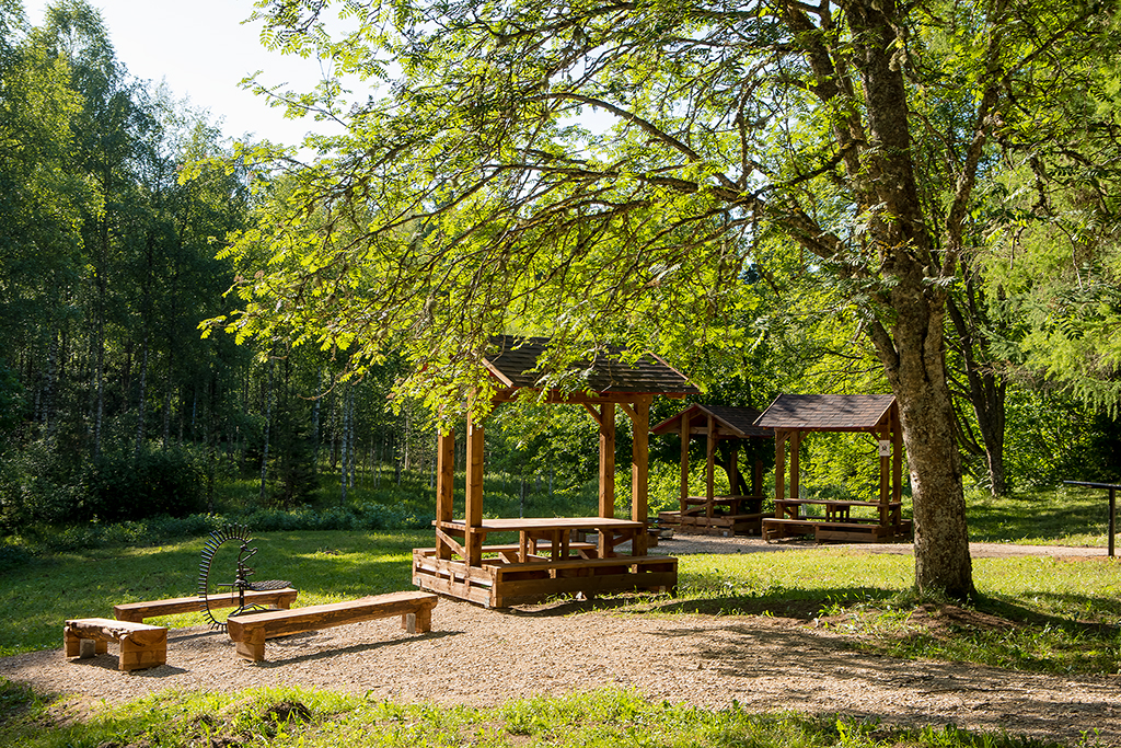
3 big and 28 small information boards, partly boardwalk, sight platform, bridge, 2 dry toilets including inva DC in the parking lot, 4 waste bins
Parking
Parking for 25 cars or 4 buses at the northeast corner of Lake Pikkjärv (Viitna Suurjärv), on the opposite side of the road.
Additional information
Before going on a nature walk please read the rules of conduct Swimming is allowed only on the northern shore of Lake Pikkjärv in Viitna and at the beach of Lake Linajärv.
Restrictions
The nature trail is situated in Viitna Landscape Protection Area. Motorised and off-road (incl. ATVs and snowmobiles) traffic is forbidden outside public roads. Camping and making campfire is not allowed in the protected area. Fishing is permitted only in Lake Linajärv. Underwater sports are also prohibited in Lake Pikkjärv in Viitna. Motorised water vehicles are prohibited on all lakes of the nature reserve. Further information can be obtained from the Environmental Board +372 662 5999, info@keskkonnaamet.ee
Contact
Telephone: +372 329 5555 +372 676 7010
E-mail: info.oandu@rmk.ee info.lahemaa@rmk.ee
Object type: study trail
Location info
Location : Lääne-Viru County, Lahemaa National Park
Viitna, Kadrina Municipality, Lääne-Viru County
Navigation instructions : Drive 73 km from Tallinn to Narva (Road no. E20), at Viitna turn right towards Kadrina. Drive 1 km until you see the information board of Viitna Landscape Reserve. Turn to the parking area at the opposite side of the road. The trail markings start from the parking area. Viitna can also be reached by public transport, it is 1 km from the Viitna bus stop to the start of the trail. From the stop, go a bit towards Narva and then turn right onto Kadrina Road. After 1 km, turn from the information board to the track.
By clicking on the map it will open the map application larger in a new window.
Telephone:
+372 329 5555 +372 676 7010
E-mail:
info.oandu@rmk.ee info.lahemaa@rmk.ee
Object type:
study trail
Location info
Location:
Lääne-Viru County, Lahemaa National Park
Viitna, Kadrina Municipality, Lääne-Viru County
Navigation instructions:
Drive 73 km from Tallinn to Narva (Road no. E20), at Viitna turn right towards Kadrina. Drive 1 km until you see the information board of Viitna Landscape Reserve. Turn to the parking area at the opposite side of the road. The trail markings start from the parking area. Viitna can also be reached by public transport, it is 1 km from the Viitna bus stop to the start of the trail. From the stop, go a bit towards Narva and then turn right onto Kadrina Road. After 1 km, turn from the information board to the track.
From Aegviidu, the trail runs further in
Lääne-Viru County, past the town of Tapa to Ohepalu and Neeruti villages, goes
through Porkuni village and through the former Soviet missile base territory to
the cone dryer at Roela.
Sights
Neeruti hills and eskers, Porkuni Landscape Reserve
Camping
At campsites and campfire sites along the hiking route.
Amenities
The trail is signposted and marked with white-yellow-white paint marks on trees. Rest stops on the trail and distances between them.
Aegviidu Visitor centre-Nikerjärve campsite 2 km
Nikerjärv campsite-Tõõrakõrve campfire site 24 km
Tõõrakõrve campfire site- Ohepalu campfire site 12,5 km
Ohepalu campfire site-Eesjärve campsite 18 km
Eesjärve campsite-Tissipuu campfire site 0,4 km
Tissipuu campfire site-Leivaahjumäe campfire site 0,4 km
Leivaahjumäe campfire site-Mardihansu campfire site 11 km
Mardihansu campfire site-Rocet Base campfire site 17 km
Rocet Base campfire site-Roela campfire site 20,5 km
The Lake Eesjärv campsite is the gateway to the Neeruti trails. It is the starting point of a nature trail that runs through the exciting estuary landscape, which, according to folk tales, are furrows ploughed by Kalevipoeg. You can choose between a 1.5 or 3.5 km long route. Information boards along the trail provide additional details about the local nature, places related to Kalevipoeg, and place names, which you can access with the help of an audio guide by scanning the QR codes. You can also swim in the lake and fish according to the rules. Across the lake, you can enjoy an enchanting view of the slopes of Sadulamägi, an ancient Estonian hillfort. The landscape is especially beautiful in autumn when the colourful silhouettes of the trees are reflected in the waters of the lake.
Sights
Lake Neeruti Eesjärv, Lake Neeruti Tagajärv, Sadulamägi hill
The campsite is located in Neeruti Landscape Reserve. Human activity is prohibited in the Sinijärve special management zone from 15 March to 15 July. Only un-motorized water vehicles are allowed on the lakes of Neeruti Landscape Reserve. On Lake Sinijärv all water vehicles are prohibited from 15 March to 15 July. Additional information from the Environmental Board +372 662 5999, info@keskkonnaamet.ee.
Contact
Telephone: +372 676 7010 +372 329 5555
E-mail: info.oandu@rmk.eeinfo.lahemaa@rmk.ee
Object type: campsite
Location info
Location : Lääne-Viru County, Neeruti Landscape Reserve
Neeruti, Kadrina Municipality, Lääne-Viru County
Navigation instructions : Drive on the Tallinn-Narva road for 63 km and keep right towards Viitna. Drive 2,4 km and turn right to Kadrina-Viitna road and drive 14,8 km. On the Kadrina roundabout turn right on the Pärnu-Rakvere-Sõmeru road and drive 3,1 km. Then turn left on the road heading to Neeruti, drive 2,8 km and you have arrived.
By clicking on the map it will open the map application larger in a new window.
Telephone:
+372 676 7010 +372 329 5555
E-mail:
info.oandu@rmk.eeinfo.lahemaa@rmk.ee
Object type:
campsite
Location info
Location:
Lääne-Viru County, Neeruti Landscape Reserve
Neeruti, Kadrina Municipality, Lääne-Viru County
Navigation instructions:
Drive on the Tallinn-Narva road for 63 km and keep right towards Viitna. Drive 2,4 km and turn right to Kadrina-Viitna road and drive 14,8 km. On the Kadrina roundabout turn right on the Pärnu-Rakvere-Sõmeru road and drive 3,1 km. Then turn left on the road heading to Neeruti, drive 2,8 km and you have arrived.
The Tissipuu campfire site is located on the Neeruti nature trail, between Lake Tagajärv and Lake Eesjärv. As there is no direct access to the campfire site by car, it is a calmer place for those hiking and walking the beautiful forest trails of Neeruti. Those who come by car can opt for the Neeruti Eesjärve campsite instead. The campfire site is named after a special spruce tree that grew nearby. After drying out, the tree was erected as a monument on the edge of the campfire site. Our common spruce takes many interesting forms: Picea abies or ‘Virgata’ has long, unbranched, winding branches, and Picea abies subsp. abies f. tuberculata has a thick cracked bark reminiscent of crocodile scales. The ‘Tissipuu’ has convex nodules at the branch collar, reminiscent of the female breast. Next to the campfire site is a bridge over the canal that connects the two lakes. From there, you can hike along the nature trail to Sadulamägi and Leivaahjumägi, and take a tour of the Neeruti esker landscape. There are information boards along the trail, but you can learn even more about the landscape, legends, and place names with the help of an audio guide. To access these, scan the QR codes on the information boards.
Sights
Lake Neeruti Eesjärv, Lake Neeruti Tagajärv, Sadulamägi hill
Hiking options
Neeruti nature trail (1,5 km and 3,5 km), RMK Penijõe-Aegviidu-Kauksi Hiking Route
Camping
Maximum number of tents (for 4) allowed is 3.
Amenities
Outdoor fireplace with grillrest, picnic table with shelter, lean-to/firewood shelter, DC 200 m in the parking lot
Parking
The parking of Neeruti nature trail for 4 cars or 1 bus.
The campfire site is located in Neeruti Landscape Reserve.
Human activity is prohibited in the Sinijärve special management zone from 15 March to 15 July.
Only un-motorized water vehicles are allowed on the lakes of Neeruti Landscape Reserve. On Lake Sinijärv all water vehicles are prohibited from 15 March to 15 July.
Further information can be obtained from the Environmental Board +372 662 5999, info@keskkonnaamet.ee
Contact
Telephone: +372 676 7010
+372 329 5555
E-mail: info.oandu@rmk.ee info.lahemaa@rmk.ee
Object type: campfire site
Location info
Location : Lääne-Viru County, Neeruti Landscape Reserve
Neeruti, Kadrina Municipality, Lääne-Viru County
Navigation instructions : Drive on the Tallinn-Narva road for 63 km and keep right towards Viitna.
Drive 2,4 km and turn right to Kadrina-Viitna road and drive 14,8 km. On
the Kadrina roundabout turn right on the Pärnu-Rakvere-Sõmeru road and
drive 3,1 km. Then turn left on the road heading to Neeruti, drive 2,8
km and you have arrived.
By clicking on the map it will open the map application larger in a new window.
Telephone:
+372 676 7010
+372 329 5555
E-mail:
info.oandu@rmk.ee info.lahemaa@rmk.ee
Object type:
campfire site
Location info
Location:
Lääne-Viru County, Neeruti Landscape Reserve
Neeruti, Kadrina Municipality, Lääne-Viru County
Navigation instructions:
Drive on the Tallinn-Narva road for 63 km and keep right towards Viitna.
Drive 2,4 km and turn right to Kadrina-Viitna road and drive 14,8 km. On
the Kadrina roundabout turn right on the Pärnu-Rakvere-Sõmeru road and
drive 3,1 km. Then turn left on the road heading to Neeruti, drive 2,8
km and you have arrived.
Campfire site is located in Porkuni Landscape Reserve. Further information can be obtained from the Environmental Board +372 662 5999, info@keskkonnaamet.ee
Parking
Not available
Contact
Telephone: +372 676 7010
E-mail: info.oandu@rmk.ee
Object type: campfire site
Location info
Location : Lääne-Viru County, Põhja-Eesti Recreation Area
Piisupi Village, Tamsalu Municipality, Lääne-Viru County
Navigation instructions : From Tamsalu-Lasila Road opposite the Lasila gravel-pit along the indicated RMK Penijõe-Aegviidu-Kauksi Hiking Route
VõimalusedHiking trail/Hiking OptionsCampingCovered fireplaceMaintenance during summerParkimine
Harju County, Põhja-Eesti Recreation Area
Campfire site for visitors of the small island in the Kolga Bay.
Hiking options
Pedassaare hiking trail
Camping
Maximum number of tents (for 4) allowed is 3.
Amenities
Outdoor fireplace, a shelter with information boards, picnic table with shelter, dry toilet. Dry firewwood can be found near the campfire site in piles, they must be cut.
The campfire site is situated in Kolga Bay Landscape Reserve. Further information can be obtained from the Environmental Board +372 662 5999, info@keskkonnaamet.ee
Contact
Telephone: +372 676 7010 +372 329 5555
E-mail: info.oandu@rmk.eeinfo.lahemaa@rmk.ee
Object type: campfire site
Location info
Location : Harju County, Põhja-Eesti Recreation Area
Salmistu Village, Kuusalu Municipality, Harju County
Navigation instructions : The campfire site is on
the western coast of Pedassaar island. The nearest ports are at Salmistu and
Kaberneeme.
Location : Harju County, Põhja-Eesti Recreation Area
Kaberneeme Village, Jõelähtme Municipality, Harju County
Navigation instructions : Drive along Tallinn–Narva road (E20) towards Narva, turn left at the Jägala junction towards Kaberneeme. Drive 12 km along Jõelähtme–Kaberneeme road to the parking area and information board to the right of the road.
By clicking on the map it will open the map application larger in a new window.
Telephone:
+372 676 7010 +372 329 5555
E-mail:
info.oandu@rmk.eeinfo.lahemaa@rmk.ee
Object type:
campfire site
Location info
Location:
Harju County, Põhja-Eesti Recreation Area
Kaberneeme Village, Jõelähtme Municipality, Harju County
Navigation instructions:
Drive along Tallinn–Narva road (E20) towards Narva, turn left at the Jägala junction towards Kaberneeme. Drive 12 km along Jõelähtme–Kaberneeme road to the parking area and information board to the right of the road.