VõimalusedHiking trail/Hiking OptionsCampingCovered fireplaceMaintenance during summer
Ida-Viru County, Peipsi põhjaranniku Recreation Area
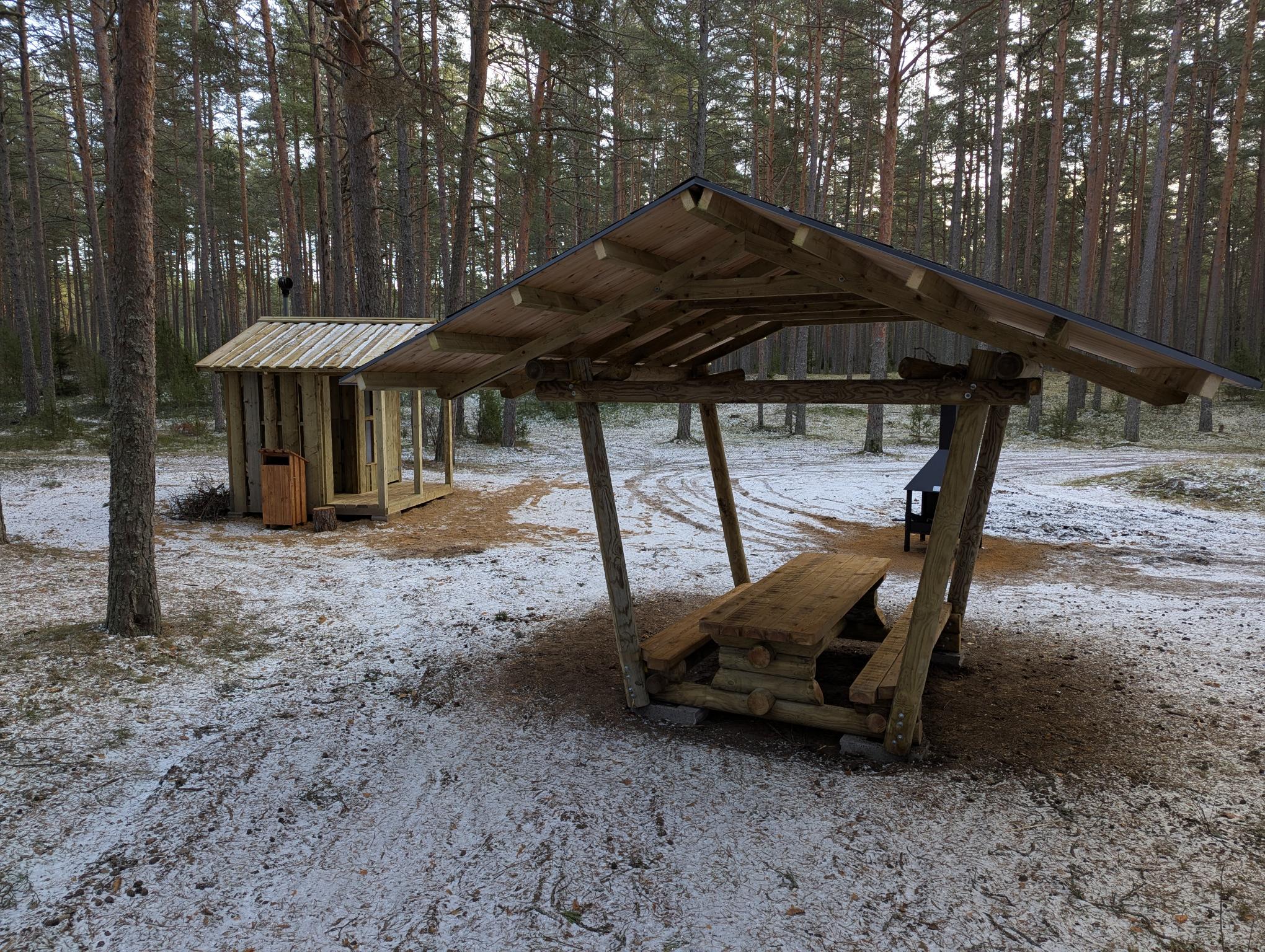
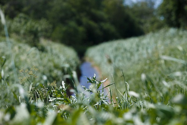
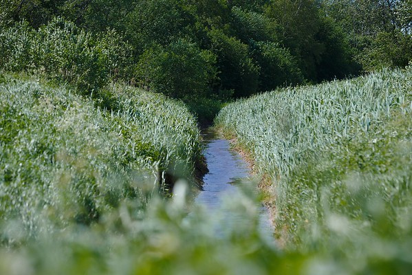
The Narva-Jõesuu campfire site is located on the RMK Hiking Route, at the 17th kilometre of the Mummassaare–Narva extension of the trail, which connects the Penijõe-Aegviidu-Kauksi branch with Narva-Jõesuu and Narva. In this way, Estonia’s easternmost cities are also linked to the RMK Hiking Route. The new section of trail has a length of 36 kilometres. The wooded area here is known as Auga Park Forest, the southwestern part of which is Auga Forest, and was most likely named after the locality of Auga. It has been a well-known swimming spot and summer destination in Narva-Jõesuu. The forest behind the town is ideal for recreation and walking, is easily accessible and, at the same time, as diverse as possible while offering exhilarating experiences. A majority of the area is the habitat type for lingonberries, on which pine stands can be found growing. A few spruce stands can be found only in the northwestern part of the area. The pine stands are up to 220 years old. There is hardly any undergrowth; although, in the more fertile areas, there are spruces, junipers, and rowans. This is a community forest, where forest management takes place under conditions agreed upon by the community and the local government. In the middle of the area are protected key habitats.
Sights
Auga Forest, sand dunes, Narva-Jõesuu resort town, beach
Amenities
Covered fire pit, covered table-bench, dry toilet, and information board
Ida-Viru County, Peipsi põhjaranniku Recreation Area
Important warning - please pay attention while travelling along the Aidu Hiking Trail! Movement takes place in the old quarry area, and attention should be paid to the ascents and descents, especially in snow and rain. Crossing in the raft is at your own risk. If possible, plan the crossing during daylight. For safety reasons, there should be no more than 4 people on the raft; or even fewer in the case of large people. The raft is propelled by the force of your hands, by pulling the rope attached to the shore. We ask that the people on the raft maintain their balance; squatting is recommend. Rocking the raft or hanging from the railings is prohibited. When crossing the canal with children, an adult must also be present on the raft. Quarry waters are insidious. Heading out onto the ice is at your own risk, provided that you are confident of your safety.
The Aidu Hiking Trail runs along the excavation area of the closed quarry, rising at times to the high slopes of the tranches and then descending again into the valley, where you can get an overview of the afforestation of the quarry areas. Along the way there are water-filled excavation areas, one of which must be crossed by a raft. The trail circles around the Aidu-Nõmme campfire site.
Sights
The Aidu quarry is one of the most unique artificial landscapes, which is finding increased reuse, both in the form of tourism and sports activities. The open-pit mine ceased operation in 2012 due to the depletion of reserves. After the quarry was closed, the driveways and mining areas began to fill with water. Thus, in the middle of a rocky desert, Estonia’s very own collection of light blue lagoons emerged, where carbonate rocks and limestone partially dissolve in water and begin to form gypsum. The water reflected from the gypsum crystals causes a beautiful light blue colour.
As you pass through the quarry, please pay attention. Movement is along the old quarry area, and attention should be paid to ascents and descents. In two places, the water-filled excavation area must be crossed with a raft. Crossing in the raft is at your own risk. If possible, plan the crossing during daylight. For safety reasons, there should be no more than 4 people on the raft; or even fewer in the case of large people. The raft is propelled by the force of your hands, by pulling the rope attached to the shore. We ask that the people on the raft maintain their balance; squatting is recommended. Rocking the raft or hanging from the railings is prohibited. When crossing the canal with children, an adult must also be present on the raft.
Amenities
Car park, covered fireplace, covered table and benches, lean-to shelter, dry toilet, waste bin, and wood shed at the Aidu-Nõmme campfire site. There are 3 large and 9 small information boards, 1 raft.
Water
Domestic water can be obtained from the water-filled mining canal.
Ida-Viru County, Peipsi põhjaranniku Recreation Area
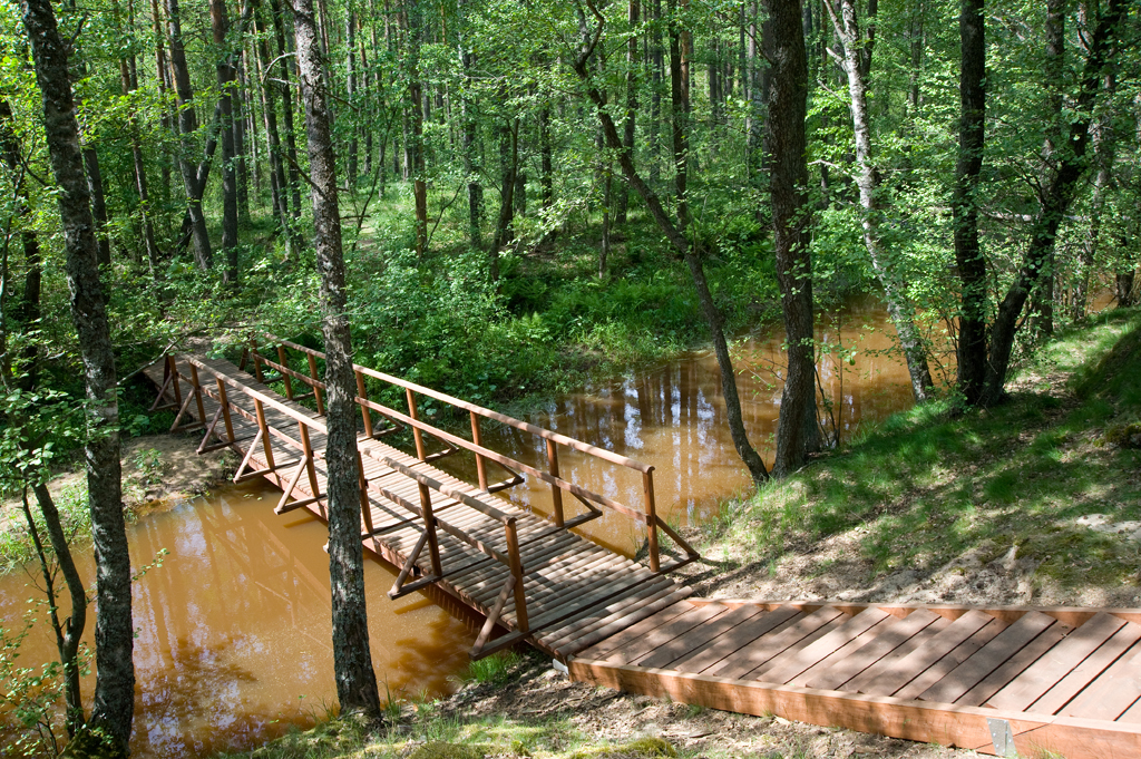
The green energy trail that runs in the area of Hõbeallika Spring and ponds of Oru Park opens up the complex topic of renewable energy in a simple and understandable way. The trail starts above the Hõbeallika cave, descends to the ponds and crosses the Pühajõe River Valley. Information points of interest help to understand how the energy we need is produced with the help of wind, sun or water and to think about the problems of green energy. On the trail, you can use virtual reality solutions to test how a hydroelectric station would look like on Pühajõe River or windmills in the local landscape. Landscape-wise, Oru park is located on a sandstone bank in the Pühajõe River valley at the mouth of klint bay. The alternating relief with the seaside plain, Neide Bank and the banks of the Pühajõe RiverValley makes the landscape of the park very varied and beautiful. Here you can see a high limestone bank, a river floodplain, a terraced valley bank on the edge of a bank cliff, an alvar and a bank slope with a deep sandy bottom. Thanks to the naturally diverse landscape, the park offers beautiful and interesting views of the surrounding landscape, the sea and the park itself.
Sights
Oru Park is one of the most popular tourist attractions with the highest species diversity and the most diverse terrain in northern Estonia. Over the 75 hectare area, you can find 258 different species of trees and shrubs, varieties or types, most of which are of ecdemic origin. Among these are, for example, Siberian pine, Dutchman’s pipe, Euro-american hybrid poplar, sweet birch, Katsura, Douglas fir, the Manchurian walnut, and many other rarities.
Hiking options
Green energy trail of Oru Park, starting above Hõbeallika Spring. The trail was co-financed by the Estonian EU external border programme.
Parking
In Toila town, at the intersection of Mere puiestee and Rannatee Street, the bus station and parking area is on the left.
Additional information
It is possible to enter the park in a wheelchair from the Karu gates parking lot along the lime tree alley. From the direction of Toila trough the Oru parking lot, along the light traffic road. Access to the entire castle grounds is guaranteed in the park. There is no wheelchair access to the ponds and Hõbeallika Spring Cave and there is no inva-toilet. The green energy trail is not accessible by wheelchair.
Restrictions
The trail is situated in Oru Park Landscape Reserve, view the restrictions on visiting here. Additional information from the Environmental Board +372 662 5999, info@keskkonnaamet.ee. According to the nature conservation rules, motorised vehicle traffic is prohibited outside the roads and paths. Use only designated sites for campfires and make sure that there are no restrictions due to wind or dry conditions.
Contact
Telephone: +372 5681 5722
E-mail: info.alutaguse@rmk.ee
Object type: study trail
Location info
Location : Ida-Viru County, Peipsi põhjaranniku Recreation Area
Toila town, Toila municipality
Navigation instructions : Drive along Tallinn–Narva road. Proceeding from Jõhvi towards Narva, right after crossing the bridge over the Pühajõgi River, there is a sign pointing to Toila. Drive 5.4 km to the town of Toila. Drive along the Mere puiestee to the entry to the Oru Park, the bus station and parking area is on the left. The second entrance "Karu gates" (coordinates BL: 59.418692, 27.531043).
By clicking on the map it will open the map application larger in a new window.
Telephone:
+372 5681 5722
E-mail:
info.alutaguse@rmk.ee
Object type:
study trail
Location info
Location:
Ida-Viru County, Peipsi põhjaranniku Recreation Area
Toila town, Toila municipality
Navigation instructions:
Drive along Tallinn–Narva road. Proceeding from Jõhvi towards Narva, right after crossing the bridge over the Pühajõgi River, there is a sign pointing to Toila. Drive 5.4 km to the town of Toila. Drive along the Mere puiestee to the entry to the Oru Park, the bus station and parking area is on the left. The second entrance "Karu gates" (coordinates BL: 59.418692, 27.531043).
VõimalusedCampingFireplaceMaintenance during summer
Ida-Viru County, Peipsi põhjaranniku Recreation Area
The campsite is located on the high bank of Lake Konsu. It is the largest lake in the Kurtna lake system, and its main species are the common roach, the European perch, and the pike.
Sights
Lake Konsu
Camping
Maximum number of tents (for 4) allowed is 100.
Amenities
Large campfire site, benches, dry toilet. Suitable for organising major outdoor events, for about 300 people.
Motorised vehicle traffic is prohibited outside roads and paths. Campfires can be made only in designated sites.
Contact
Telephone: +372 5681 5722
E-mail: info.alutaguse@rmk.ee
Object type: campsite
Location info
Location : Ida-Viru County, Peipsi põhjaranniku Recreation Area
Alutaguse municipality, Ida-Viru county
Navigation instructions : Drive
17 km on Jõhvi–Vasknarva road, turn left (at the sign to Niinsaare recreation
area) and drive 3 km straight ahead to a junction. Keep to the road on the
right, which turns into a gravel road. Drive about 5 km until the road ascends
to a hill and after another 1 km you will arrive at the campsite at the left
side of the road.
By clicking on the map it will open the map application larger in a new window.
Telephone:
+372 5681 5722
E-mail:
info.alutaguse@rmk.ee
Object type:
campsite
Location info
Location:
Ida-Viru County, Peipsi põhjaranniku Recreation Area
Alutaguse municipality, Ida-Viru county
Navigation instructions:
Drive
17 km on Jõhvi–Vasknarva road, turn left (at the sign to Niinsaare recreation
area) and drive 3 km straight ahead to a junction. Keep to the road on the
right, which turns into a gravel road. Drive about 5 km until the road ascends
to a hill and after another 1 km you will arrive at the campsite at the left
side of the road.
Motorised vehicle traffic is prohibited outside roads and paths within 50 m shore protection zone. Campfires can be made only in designated sites.
Contact
Telephone: +372 5681 5722
E-mail: info.alutaguse@rmk.ee
Object type: study trail
Location info
Location : Ida-Viru County, Peipsi põhjaranniku Recreation Area
Kauksivillage, Iisaku municipality, Ida-Viru County
Navigation instructions : Drive 47 km along Jõhvi–Tartu road, turn left at the Kauksi bus stop (sign to Visitor Centre of Alutaguse National Park). Drive 600 m ahead, until you can see the Visitor Centre at the right side of the road. The trail starts in the yard of the Visitor Centre.
By clicking on the map it will open the map application larger in a new window.
Telephone:
+372 5681 5722
E-mail:
info.alutaguse@rmk.ee
Object type:
study trail
Location info
Location:
Ida-Viru County, Peipsi põhjaranniku Recreation Area
Kauksivillage, Iisaku municipality, Ida-Viru County
Navigation instructions:
Drive 47 km along Jõhvi–Tartu road, turn left at the Kauksi bus stop (sign to Visitor Centre of Alutaguse National Park). Drive 600 m ahead, until you can see the Visitor Centre at the right side of the road. The trail starts in the yard of the Visitor Centre.
Lääne-Viru County, Peipsi põhjaranniku Recreation Area
The study trail introduces the Seljamägi hill, pine forest, transition mire, Põdraallikad (spirngs) and offers scenic views of the wildlife. Hikers can have a rest and prepare food at the campfire site.
Sights
Seljamägi hill, heath pine forest, transition mire, Põdra (“Moose”) springs.
Amenities
The parking area between the bogs of Punasoo and Järvesoo, recreation shelter, campfire site. There is a campfire site, a point of interest, 2 pavilions along the trail.
Tudusoo Nature Reserve. According to the nature conservation rules, motorised vehicle traffic is prohibited outside roads and paths. Campfires can be made only in designated sites.
Contact
Telephone: +372 5681 5722
E-mail: info.alutaguse@rmk.ee
Object type: study trail
Location info
Location : Lääne-Viru County, Peipsi põhjaranniku Recreation Area
Vinni municipality, Lääne -Viru county
Navigation instructions : Drive
along Rakvere–Rannapungerja road and turn right 800 m before Tudu town (at the
sign to the Seljamäe hiking trail). Drive 5 km to the parking area with a
pavilion and a campfire site to your left. The hiking trail starts opposite to
the parking area.
By clicking on the map it will open the map application larger in a new window.
Telephone:
+372 5681 5722
E-mail:
info.alutaguse@rmk.ee
Object type:
study trail
Location info
Location:
Lääne-Viru County, Peipsi põhjaranniku Recreation Area
Vinni municipality, Lääne -Viru county
Navigation instructions:
Drive
along Rakvere–Rannapungerja road and turn right 800 m before Tudu town (at the
sign to the Seljamäe hiking trail). Drive 5 km to the parking area with a
pavilion and a campfire site to your left. The hiking trail starts opposite to
the parking area.
Ida-Viru County, Peipsi põhjaranniku Recreation Area
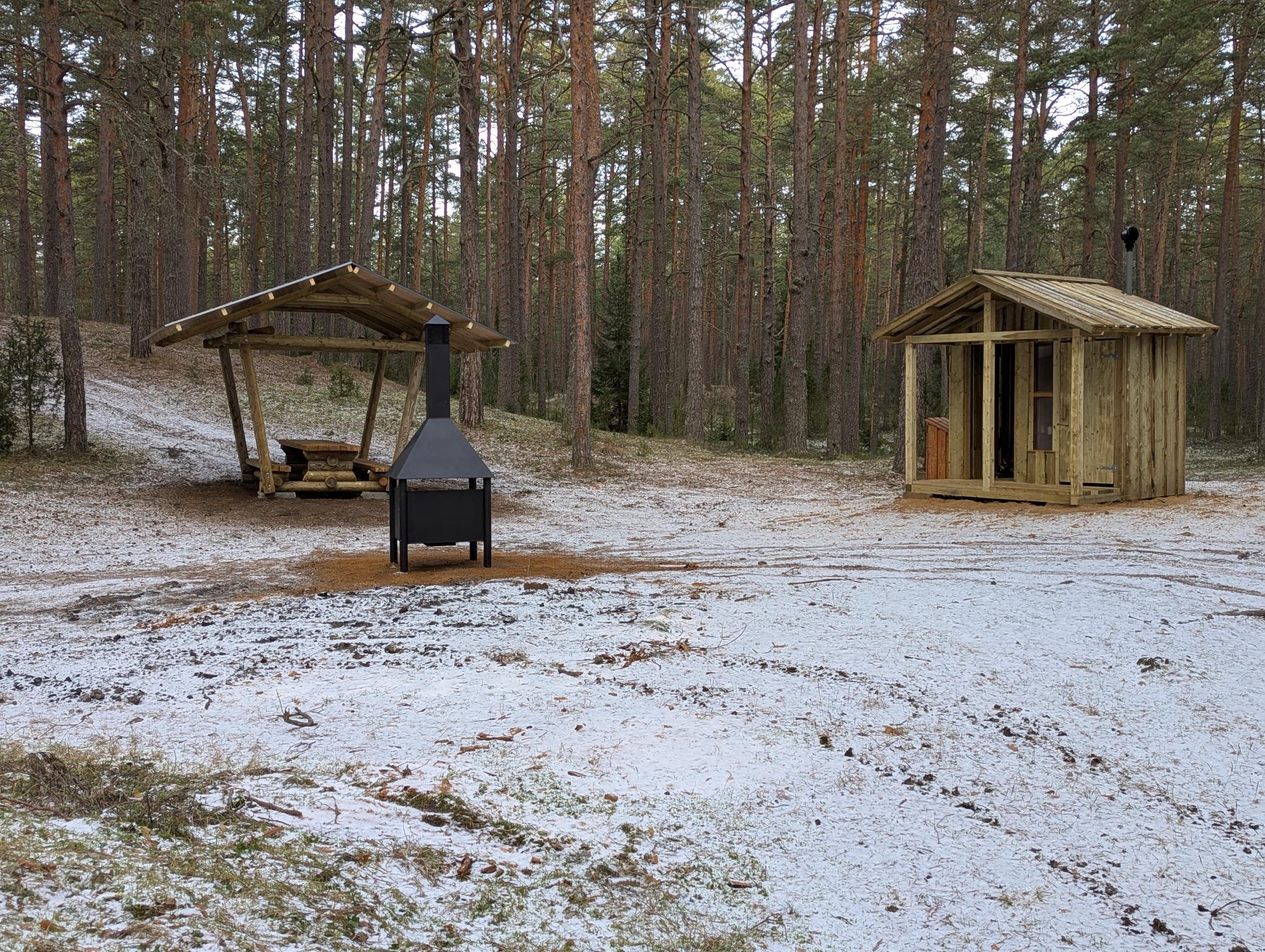
Located on the territory of the closed Aidu quarry, in the village of Aidu-Nõmme. About 800 m from Kohtla-Nõmme Maidla Road, which runs through the quarry, in a young pine forest, on the shore of a water-filled excavation area that resembles a fjord due to its light blue water and high banks. The Aidu Hiking Trail also starts from the campfire site.
Sights
Aidu mine is one of the most impressive artificial landscapes in Estonia. Mining ended in 2012, after that the mine and roads started to fill with water: in the middle of a stone desert appeared a blue lagoon.
Location : Ida-Viru County, Peipsi põhjaranniku Recreation Area
Aidu, Ida-Viru county
Navigation instructions : From Tallinn-Narva Road turn to Kohtla-Järve, move on to Kohtla-Nõmme. Turn left from Estonian Mining Museum, drive around the Mining Museum`s territory along the paved roads of the mine towards Maidla 7 km until there is the sign on the left "Aidu-Liiva lõkkekoht". Follow the signs until the campfire site.
By clicking on the map it will open the map application larger in a new window.
Telephone:
+372 5681 5722
E-mail:
info.alutaguse@rmk.ee
Object type:
campfire site
Location info
Location:
Ida-Viru County, Peipsi põhjaranniku Recreation Area
Aidu, Ida-Viru county
Navigation instructions:
From Tallinn-Narva Road turn to Kohtla-Järve, move on to Kohtla-Nõmme. Turn left from Estonian Mining Museum, drive around the Mining Museum`s territory along the paved roads of the mine towards Maidla 7 km until there is the sign on the left "Aidu-Liiva lõkkekoht". Follow the signs until the campfire site.
Ida-Viru County, Peipsi põhjaranniku Recreation Area
Located in the territory of the closed Aidu quarry, in the village of Aidu, in a young pine forest, on the shore of a water-filled excavation area. The body of water resembles a fjord due to its light blue water and high banks. The campfire site is located on RMK’s hiking trail, and 1.5 km away as the crow flies is the Aidu Water Sports Centre.
Sights
Aidu mine is one of the most impressive artificial landscapes in Estonia. Mining ended in 2012, after that the mine and roads started to fill with water: in the middle of a stone desert appeared a blue lagoon.
Location : Ida-Viru County, Peipsi põhjaranniku Recreation Area
Aidu, Ida-Viru County
Navigation instructions : From Tallinn-Narva Road turn to Kohtla-Järve, move on to Kohtla-Nõmme. Turn left from Estonian Mining Museum, drive around the Mining Museum`s territory along the paved roads of the mine towards Maidla 2,5 km until there is the sign on the left "Aidu-Nõmme lõkkekoht". Drive 830 m gravel road, after rise and fall you reach the campfire site.
By clicking on the map it will open the map application larger in a new window.
Telephone:
+372 5681 5722
E-mail:
info.alutaguse@rmk.ee
Object type:
campfire site
Location info
Location:
Ida-Viru County, Peipsi põhjaranniku Recreation Area
Aidu, Ida-Viru County
Navigation instructions:
From Tallinn-Narva Road turn to Kohtla-Järve, move on to Kohtla-Nõmme. Turn left from Estonian Mining Museum, drive around the Mining Museum`s territory along the paved roads of the mine towards Maidla 2,5 km until there is the sign on the left "Aidu-Nõmme lõkkekoht". Drive 830 m gravel road, after rise and fall you reach the campfire site.
Ida-Viru County, Peipsi põhjaranniku Recreation Area
Located in Lüganuse Rural Municipality, Aa Village, 1 km south of the Tallinn-Narva Highway, along roads running through fields, on the edge of the old Alulinna marsh stronghold. It is the most easterly known ancient stronghold in Viru County. The name Alutaguse is thought to derive from the name Alulinna. According to ancient tradition, Alulinna was built by a witch to house an older daughter she had kidnapped.
Sights
The ruins of the old castle Alulinn and the archaeological landscape
The area is under the protection of national heritage: digging and breaking the ruins is not allowed.
Contact
Telephone: +372 5681 5722
E-mail: info.alutaguse@rmk.ee
Object type: campfire site
Location info
Location : Ida-Viru County, Peipsi põhjaranniku Recreation Area
Lüganuse Community, Ida-Viru County
Navigation instructions : 147.km of Tallinn-Narva Road turn right after Aa bus stop. Drive the gravel road 320 m and turn left to the way between the fields. Drive 740 m and follow the sign to the right, drive until Alulinn and the campfire sight.
By clicking on the map it will open the map application larger in a new window.
Telephone:
+372 5681 5722
E-mail:
info.alutaguse@rmk.ee
Object type:
campfire site
Location info
Location:
Ida-Viru County, Peipsi põhjaranniku Recreation Area
Lüganuse Community, Ida-Viru County
Navigation instructions:
147.km of Tallinn-Narva Road turn right after Aa bus stop. Drive the gravel road 320 m and turn left to the way between the fields. Drive 740 m and follow the sign to the right, drive until Alulinn and the campfire sight.
Ida-Viru County, Peipsi põhjaranniku Recreation Area
Located in the town of Toila, below the limestone bank on Ranna Street, in the area of the old fishing port. The campfire site is located right on the shores of Narva Bay, and only the remnants of the surviving port pier that extends into the sea testify to the former existence of the old port. The current port of Toila is located 1.7 km from here, along the beach, and Oru Park is located 1.5 km along RMK’s hiking trail.
Sights
Former fishing harbour, cobblestone road leading to the harbour. In addition to boats, there were sheds for fishing nets and ovens for smoking fish on the coast under the steep cliff. The partially preserved road and the remains of the breakwater are reminders of the good old days.
Hiking options
RMK Penijõe-Aegviidu-Kauksi hiking route
Camping
Maximum number of tents (for 4) allowed is 5.
Amenities
Outdoor fireplace, picnic table with shelter, lean-to, dry toilet, shed for firewood, information board
Parking
In Toila on Ranna street for up to 6 cars.
Additional information
The old coastal road has been partially washed away and can be very slippery during wet seasons. Before going on a nature walk please read the rules of conduct
Contact
Telephone: +372 5681 5722
E-mail: info.alutaguse@rmk.ee
Object type: campfire site
Location info
Location : Ida-Viru County, Peipsi põhjaranniku Recreation Area
Toila, Ida-Viru county
Navigation instructions : Take the Tallinn–Narva road. On the road after Jõhvi, after crossing the bridge over the Pühajõe river, a sign directs you towards Toila. Drive 5.4 km to Toila, turn left at Toila bus station to Pikk street, after 1.3 km turn left to Ranna street. Drive 80 m and park your car on the left side of the street at the stone wall. Go down along the old fishing harbour road 700 m to Toila campfire site.
By clicking on the map it will open the map application larger in a new window.
Telephone:
+372 5681 5722
E-mail:
info.alutaguse@rmk.ee
Object type:
campfire site
Location info
Location:
Ida-Viru County, Peipsi põhjaranniku Recreation Area
Toila, Ida-Viru county
Navigation instructions:
Take the Tallinn–Narva road. On the road after Jõhvi, after crossing the bridge over the Pühajõe river, a sign directs you towards Toila. Drive 5.4 km to Toila, turn left at Toila bus station to Pikk street, after 1.3 km turn left to Ranna street. Drive 80 m and park your car on the left side of the street at the stone wall. Go down along the old fishing harbour road 700 m to Toila campfire site.