The total length of Taagepera hiking trail is 5.4 km. The trail starts and ends at Taagepera campfire site, which offers a possibility of camping and making campfire. Traces of beaver activity, wood ants and rich forests – with larches, firs, oaks etc. – can be seen on the trail along the Õhne river. The trail can also be completed in shorter rounds of 1.6 km and 4.0 km. More precise trail information can be found on the board.
Sights
Taagepera Manor and park, Taagepera Church and graveyard, family burial place of the local barons, "Last Kiss", a sacrificial rock, underground cemetery, Õhne river.
The hill fort of Lõhavere was occupied by a local Estonian chieftain Lembitu during the Late Iron Age. It is one of the most thoroughly studied hill forts in Estonia. Major archaeological excavations have been conducted on the site since the late 19th century and almost two thirds of the stronghold has been excavated. Many of the stronghold’s details correspond to the description of the castle written in the Livonian Chronicle by a priest called Henry of Latvia in 1215. The stronghold has been built on a moraine hill which rises 8 to 10 meters above the surrounding terrain. Encircling the top of the hill is a man-made sand wall, which was originally supported from inside by a 2.5 meter timber wall. Timber structures were built on the top of the wall. The main gate of the hill fort was on the north side and was probably protected by a wooden tower.
Sights
A memorial “To the defenders of Sakala 1217-1223” designed by sculptor Renaldo Veeber and architect Ülo Stöör was opened in 1969.
Amenities
Gathering place with benches, information board and historical comic storyboards. A trail marked with arrows and a metal stair lead to the main gate of the hill fort. To return from the hill fort to the parking lot there is a wooden staircase.
Location : Viljandi County, Sakala Recreation Area
Lõhavere village, Põhja-Sakala municipality, Viljandi county
Navigation instructions : Drive 31 km along Imavere–Viljandi road and turn towards Vändra. Drive 6.8 km up to Suure-Jaani junction, where the sign “Lõhavere linnamägi 2 km” directs to the right. Drive about 2 km through Kõidama village and turn left, following the sign “Lõhavere linnamägi”. Drive about 1.1 km and you are there.
By clicking on the map it will open the map application larger in a new window.
Telephone:
+372 526 1924
E-mail:
info.soomaa@rmk.ee
Object type:
rest stop
Location info
Location:
Viljandi County, Sakala Recreation Area
Lõhavere village, Põhja-Sakala municipality, Viljandi county
Navigation instructions:
Drive 31 km along Imavere–Viljandi road and turn towards Vändra. Drive 6.8 km up to Suure-Jaani junction, where the sign “Lõhavere linnamägi 2 km” directs to the right. Drive about 2 km through Kõidama village and turn left, following the sign “Lõhavere linnamägi”. Drive about 1.1 km and you are there.
Located in Mukri Landscape Reserve. Further information can be obtained from the Environmental Board +372 662 5999, info@keskkonnaamet.ee
Contact
Telephone: +372 526 1924
E-mail: info.soomaa@rmk.ee
Object type: campfire site
Location info
Location : Rapla County, Mukri Nature Reserve
Mukri village, Kehtna municipality, Rapla County
Navigation instructions : From Tallinn: Drive to Rapla. From Rapla drive by Rapla-Türi road. From Lelle crossroads turn towards Eidapere and drive 15 km. From Eidapere turn left after the railroad crossing and drive 1.3 km. The campsite is on your right by the road.
By clicking on the map it will open the map application larger in a new window.
Telephone:
+372 526 1924
E-mail:
info.soomaa@rmk.ee
Object type:
campfire site
Location info
Location:
Rapla County, Mukri Nature Reserve
Mukri village, Kehtna municipality, Rapla County
Navigation instructions:
From Tallinn: Drive to Rapla. From Rapla drive by Rapla-Türi road. From Lelle crossroads turn towards Eidapere and drive 15 km. From Eidapere turn left after the railroad crossing and drive 1.3 km. The campsite is on your right by the road.
Located in Mukri Nature Reserve. Further information can be obtained from the Environmental Board +372 662 5999, info@keskkonnaamet.ee
Contact
Telephone: +372 526 1924
E-mail: info.soomaa@rmk.ee
Object type: hiking trail
Location info
Location : Rapla County, Mukri Nature Reserve
Mukri village, Kehtna municipality, Rapla county
Navigation instructions : Drive to Rapla. From Rapla drive by Rapla-Türi road. From Lelle
crossroads turn towards Eidapere and drive 15 km. From Eidapere turn
left after the railroad crossing and drive 1.3 km. The trail is on
your right by the road.
By clicking on the map it will open the map application larger in a new window.
Telephone:
+372 526 1924
E-mail:
info.soomaa@rmk.ee
Object type:
hiking trail
Location info
Location:
Rapla County, Mukri Nature Reserve
Mukri village, Kehtna municipality, Rapla county
Navigation instructions:
Drive to Rapla. From Rapla drive by Rapla-Türi road. From Lelle
crossroads turn towards Eidapere and drive 15 km. From Eidapere turn
left after the railroad crossing and drive 1.3 km. The trail is on
your right by the road.
The observation tower is located on the Mukri nature trail and offers beautiful views of the Mukri bog, bog pools and forests. The trail has three branches, and the shortest way to the observation tower is along the middle branch, which does not have a separate parking lot. It is 670 m from the parking lot through the southeast branch to the observation tower.
Sights
Mukri bog
Amenities
Covered 18 meter high observation tower, information board
Located in Mukri Nature Reserve. Further information can be obtained from the Environmental Board +372 662 5999, info@keskkonnaamet.ee
Contact
Telephone: +372 526 1924
E-mail: info.soomaa@rmk.ee
Object type: observation tower
Location info
Location : Rapla County, Mukri Nature Reserve
Mukri village, Kehtna municipality, Rapla county
Navigation instructions :The observation tower’s location marker on the map shows the location of the study trail's parking lot. Drive to Rapla. From Rapla drive by Rapla-Türi road. From Lelle
crossroads turn towards Eidapere and drive 15 km. From Eidapere turn
left after the railroad crossing and drive 1.3 km. The trail is on
your right by the road.
By clicking on the map it will open the map application larger in a new window.
Telephone:
+372 526 1924
E-mail:
info.soomaa@rmk.ee
Object type:
observation tower
Location info
Location:
Rapla County, Mukri Nature Reserve
Mukri village, Kehtna municipality, Rapla county
Navigation instructions:
The observation tower’s location marker on the map shows the location of the study trail's parking lot. Drive to Rapla. From Rapla drive by Rapla-Türi road. From Lelle
crossroads turn towards Eidapere and drive 15 km. From Eidapere turn
left after the railroad crossing and drive 1.3 km. The trail is on
your right by the road.
Study trailCircular trailCampingCovered fireplaceYear-round maintenance
Viljandi County, Sakala Recreation Area
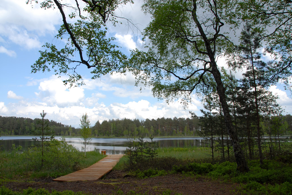
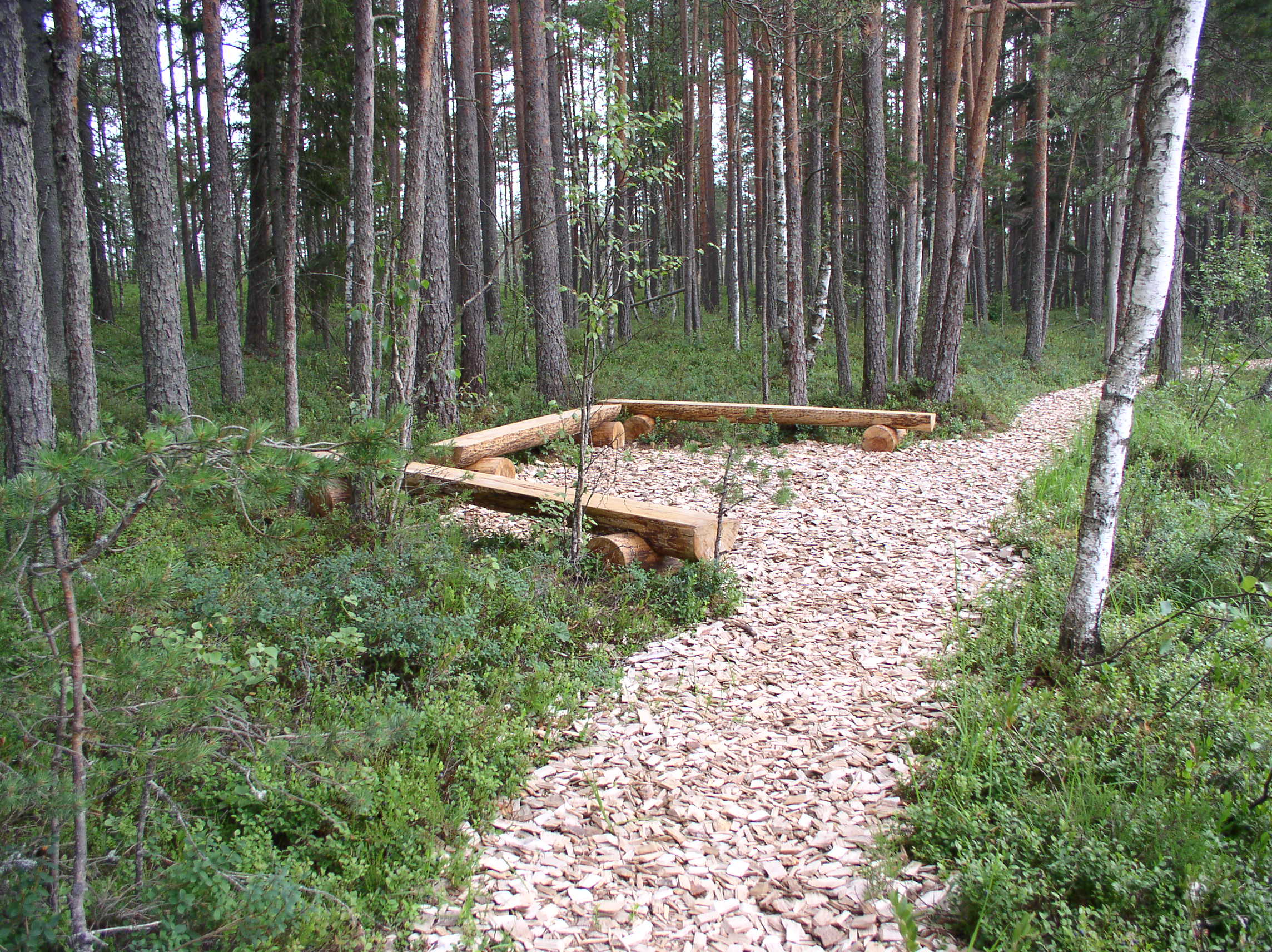
The 4.5 km loop trail is ideal for people who are not wearing special hiking clothes. The boardwalk safe wood-chip path take the visitor across several bog islands. Information boards along the trail give an ample overview of wild animals and bog communities. Starting from July it is possible to try cloudberries, crowberries (Empetrum nigrum), bilberries, bog bilberries, cowberries and cranberries along the trail. After a healthy picnic you can go for a refreshing swim in the brown-water Lake Alatsi.
Sights
The boardwalk leads you through bog islands with different forest communities, bog with stunted pine trees, and to the pool lake of Alatsi, where it is possible to go swimming. Varied vegetation.
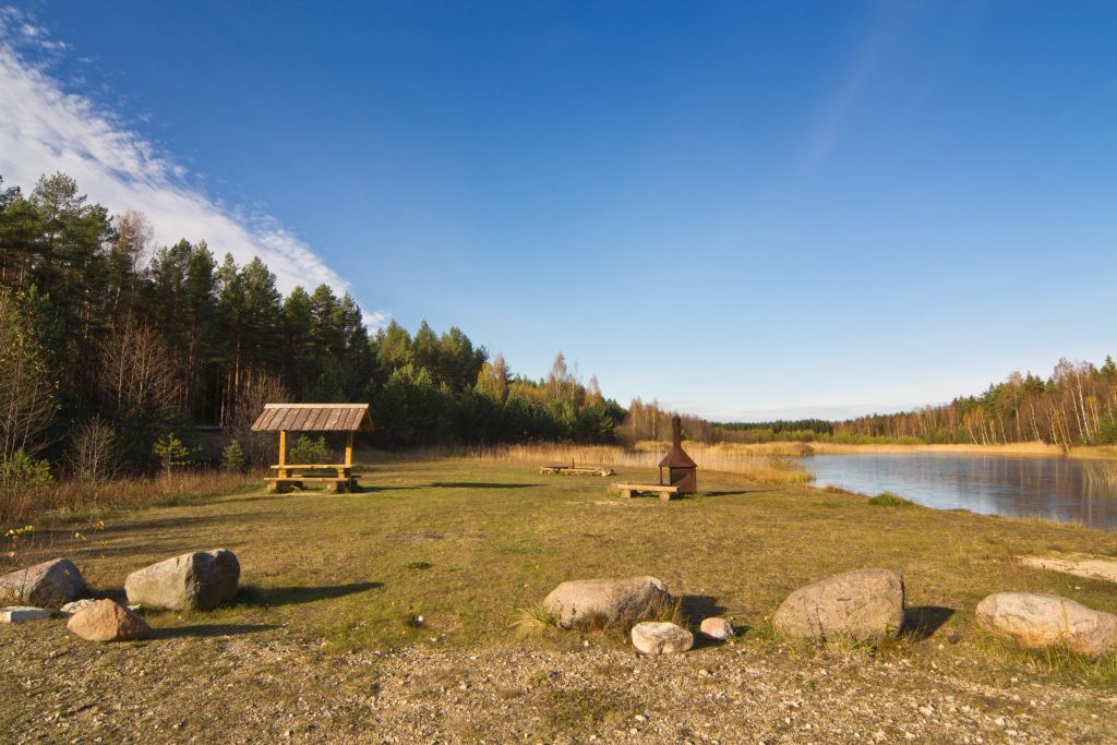
Camping
At the campfire site Teringi.
Amenities
In the parking area at the start of the trail there is an information board, a outdoor fireplace with shelter and a tent camping area. Along the trail there are several small information boards, recreation sites and a swimming pier at Lake Alatsi. The trail map is available in the information point.
Location : Viljandi County, Sakala Recreation Area
Lilli village, Mulgi municipality, Viljandi county
Navigation instructions : Drive along Valga–Uulu road and after the sign of Karksi-Nuia (when coming from Valga) turn left (follow the sign “Lilli 12 km”). When coming from the direction of Pärnu, drive straight through the town of Karksi-Nuia towards Valga and before the town border follow the sign “Lilli 12 km”. Drive to the centre of Lilli village, and follow the sign to the left “Teringi maastikukaitseala 1,5 km”. The study trail starts at the roadside parking area.
By clicking on the map it will open the map application larger in a new window.
Telephone:
+372 526 1924
E-mail:
info.soomaa@rmk.ee
Object type:
study trail
Location info
Location:
Viljandi County, Sakala Recreation Area
Lilli village, Mulgi municipality, Viljandi county
Navigation instructions:
Drive along Valga–Uulu road and after the sign of Karksi-Nuia (when coming from Valga) turn left (follow the sign “Lilli 12 km”). When coming from the direction of Pärnu, drive straight through the town of Karksi-Nuia towards Valga and before the town border follow the sign “Lilli 12 km”. Drive to the centre of Lilli village, and follow the sign to the left “Teringi maastikukaitseala 1,5 km”. The study trail starts at the roadside parking area.
Hiking trail/Hiking OptionsCircular trailCampingMaintenance during summerParking
Järva County, Sakala Recreation Area
The trail is very difficult to pass!
Measuring 9.7 km in length, the circular trail offers hikers the chance to enjoy the varied natural landscape along the beautiful shores of the Saarjõgi River. Starting and ending at the Saeveski forest hut, the trail provides tired hikers with a place to rest under the roof. A respite is needed after completing this trail, as it is intended only for a well-equipped, fit hikers. There are no smooth boardwalks or wide wood chip paths here. Only blue signs on trees and a sense of direction aided by GPS provided guidance. Beavers, bark beetles and storm winds have made sure that no step can be taken without effort. As this is a special protection zone within the Saarjõe Landscape Protection Area, fallen trees have been left to nature. As long as nature is active, Saarjõe remains a favourite place for extreme sports enthusiasts to test their climbing and orienteering skills. Fortunately, these efforts are rewarded with fresh air, birdsong, and views of the river winding between the sandy banks. Perhaps you will see a kingfisher… Hikers should take into account that, depending on the season, the trail can be very wet at times, and water may seep in from your boot leg. As is typical of old natural forests, there are all sorts of obstacles to enliven the trail, which must be crossed with the next blue marking in mind. This trail is suitable for experienced hikers.
Sights
The trail largely follows the route of the river Saarjõgi with its valley, which in places is 5 m deep and 40-50 m wide. Varied landscape, different forest communities and cultural heritage objects. Along the trail there are the dunes of the onetime Baltic Ice Lake, popularly known as Kabelimägi hills.
Camping
Camping is possible at Metsavenna campfire site and Saeveski forest hut.
Amenities
There are several information boards along the trail, introducing objects
Parking
Saeveski parking area and Metsavenna campfire site.
The trail is in Saarjõe Landscape Protection Area. Further information can be obtained from the Environmental Board +372 662 5999, info@keskkonnaamet.ee
Contact
Telephone: +372 526 1924
E-mail: info.soomaa@rmk.ee
Object type: hiking trail
Location info
Location : Järva County, Sakala Recreation Area
Rassi village, Türi municipality, Järva county
Navigation instructions : On Imavere–Viljandi road, 31 km from Imavere turn towards Vändra and drive 11.3 km to the sign “Jälevere 4 km”. Follow the sign to the right and drive 9 km through Jälevere to the centre of Tõrvaaugu village, where the sign “Türi 23 km” directs to the left. Drive towards Türi to the Rassi bus stop (about 2.6 km) and the sign “Saeveski metsaonn” on the left. Follow the sign for about 4.4 km, then turn right (follow the sign “Saeveski metsaonn”). Drive about 400 m across the bridge and you’ll arrive at the parking area of Saeveski forest hut. When approaching from the direction of Türi, follow the sign “Rassi 19 km”. At the Rassi bus stop turn right towards Saeveski. When coming from the direction of Vändra, drive about 22 km along Vändra–Suure-Jaani road and then turn left towards Saeveski forest hut. Drive 4.6 km and turn right, drive 2.5 km to the road fork, keep right and continue ahead for 0.4 km. The study trail starts at the campfire site near the forest hut.
By clicking on the map it will open the map application larger in a new window.
Telephone:
+372 526 1924
E-mail:
info.soomaa@rmk.ee
Object type:
hiking trail
Location info
Location:
Järva County, Sakala Recreation Area
Rassi village, Türi municipality, Järva county
Navigation instructions:
On Imavere–Viljandi road, 31 km from Imavere turn towards Vändra and drive 11.3 km to the sign “Jälevere 4 km”. Follow the sign to the right and drive 9 km through Jälevere to the centre of Tõrvaaugu village, where the sign “Türi 23 km” directs to the left. Drive towards Türi to the Rassi bus stop (about 2.6 km) and the sign “Saeveski metsaonn” on the left. Follow the sign for about 4.4 km, then turn right (follow the sign “Saeveski metsaonn”). Drive about 400 m across the bridge and you’ll arrive at the parking area of Saeveski forest hut. When approaching from the direction of Türi, follow the sign “Rassi 19 km”. At the Rassi bus stop turn right towards Saeveski. When coming from the direction of Vändra, drive about 22 km along Vändra–Suure-Jaani road and then turn left towards Saeveski forest hut. Drive 4.6 km and turn right, drive 2.5 km to the road fork, keep right and continue ahead for 0.4 km. The study trail starts at the campfire site near the forest hut.
Study trailCampingCovered fireplaceYear-round maintenancePublic transportParking
Viljandi County, Sakala Recreation Area
The study trail is an excellent supplement to the Heimtali manor complex. To get to the start of the trail, drive towards Viljandi from the centre of Heimtali Manor. The parking area is near a small castle-like building – the old distillery. The trail passes the only Estonian lime forest in Heimtal and is intended for nature-lovers, who are interested in mighty broadleaved trees. The trunks of giant trees are covered with various rare mosses, many of which are characteristic species of the valuable habitat.
Sights
The study trail is next to Heimtali distillery and introduces the most widespread broadleaved hardwood trees in Estonia.
Amenities
At the beginning of the trail there is a parking lot, information board, toilet. The trail is partly covered with chopped wood.
Camping
The nearest camping area and campfire site is at Sinialliku.
Location : Viljandi County, Sakala Recreation Area
Heimtali village, Viljandi municipality, Viljandi county
Navigation instructions : On Imavere–Karksi-Nuia road, 26 km from Imavere, turn right before Lake Viljandi towards Heimtali and drive 4.8 km to Heimtali distillery. The parking area is by the road on the right, and the study trail starts on the left side of the road, 30 m before the parking area. When coming from the direction of Pärnu, drive 41 km from Kilingi-Nõmme towards Viljandi, turn right towards Heimtali and drive 2.5 km to the centre of Heimtali. Turn left there, go past the round stable and the schoolhouse in the park and descend to the valley. The parking area is to the left of the road. Walk back 30 m along the road from the parking area to the start of the study trail.
By clicking on the map it will open the map application larger in a new window.
Telephone:
+372 526 1924
E-mail:
info.soomaa@rmk.ee
Object type:
study trail
Location info
Location:
Viljandi County, Sakala Recreation Area
Heimtali village, Viljandi municipality, Viljandi county
Navigation instructions:
On Imavere–Karksi-Nuia road, 26 km from Imavere, turn right before Lake Viljandi towards Heimtali and drive 4.8 km to Heimtali distillery. The parking area is by the road on the right, and the study trail starts on the left side of the road, 30 m before the parking area. When coming from the direction of Pärnu, drive 41 km from Kilingi-Nõmme towards Viljandi, turn right towards Heimtali and drive 2.5 km to the centre of Heimtali. Turn left there, go past the round stable and the schoolhouse in the park and descend to the valley. The parking area is to the left of the road. Walk back 30 m along the road from the parking area to the start of the study trail.
Parika Väikejärve study trail (there and back 3 km)
Võimalused
Study trailCampingYear-round maintenanceParking
Viljandi County, Sakala Recreation Area
The study trail is well known for the small heart-shaped bog lake. The aerial photo of the lake decorates many publications of Viljandi County. The trail is excellent for groups, because the wood-chip path to the lake is wide enough. The path is also suitable for people with reduced mobility. Around the trail there are pine forests rich in bilberries, further in the bog both cloudberries and cranberries can be found. Possible to go for a rejuvenating swim in the bog lake.
Camping
The nearest camping area and campfire site is at Lõhavere.
Amenities
At the parking area an information board and dry toilet. Wide wood-chip path goes through the bog pine forest to the heart-shaped Lake Parika Väikejärv. On lakeshore there is a recreation site with shelter, and a wooden pier with ladder. The trail around the lake is partly covered with wood chips and partly earth track. Short boardwalk takes you to bog pools. There are several recreation sites along the trail. The information boards along the trail are placed on massive carved wooden posts.
The study trail is situated in Parika Nature Reserve. Further information can be obtained from the Environmental Board +372 662 5999, info@keskkonnaamet.ee
Contact
Telephone: +372 526 1924
E-mail: info.soomaa@rmk.ee
Object type: study trail
Location info
Location : Viljandi County, Sakala Recreation Area
Aimla village, Põhja-Sakala municipality, Viljandi county
Navigation instructions : Drive 30 km on Imavere–Viljandi road and turn left towards Tääksi, continue 9.2 km to the centre of Aimla village, and follow the “Parika väikejärve õpperada 2,1 km” to the left. Drive 2.1 km to the parking space, which is to the left of the road before the start of the study trail. When coming from Viljandi, turn from Tallinn road to Musta tee, and drive 13.7 km towards Põltsamaa to the Aimla tee bus stop. Turn left and drive 3.6 km to the centre of Aimla village and follow the sign “Parika väikejärve õpperada 2,1 km”.
By clicking on the map it will open the map application larger in a new window.
Telephone:
+372 526 1924
E-mail:
info.soomaa@rmk.ee
Object type:
study trail
Location info
Location:
Viljandi County, Sakala Recreation Area
Aimla village, Põhja-Sakala municipality, Viljandi county
Navigation instructions:
Drive 30 km on Imavere–Viljandi road and turn left towards Tääksi, continue 9.2 km to the centre of Aimla village, and follow the “Parika väikejärve õpperada 2,1 km” to the left. Drive 2.1 km to the parking space, which is to the left of the road before the start of the study trail. When coming from Viljandi, turn from Tallinn road to Musta tee, and drive 13.7 km towards Põltsamaa to the Aimla tee bus stop. Turn left and drive 3.6 km to the centre of Aimla village and follow the sign “Parika väikejärve õpperada 2,1 km”.
Mädara village, Põhja-Pärnumaa municipality, Pärnu County
Navigation instructions : Coming from Pärnu: drive along Vändra and after 9.5 km, just before the Mädara river, turn left. After 900 m, turn right and cross the Mädara River. Drive 3 km along sand dunes and motocross tracks. On the right side of the road there is a parking lot and the Kellissaare campfire site.
Coming from the north (Tallinn and Rakvere): Drive along the Rakvere-Pärnu highway towards Vändra and before Vändra, immediately after the Mädara river, turn right. Drive 3 km along sand dunes and motocross tracks. On the right side of the road there is a parking lot and the Kellissaare campfire site.
By clicking on the map it will open the map application larger in a new window.
Telephone:
+372 526 1924
E-mail:
info.soomaa@rmk.ee
Object type:
campfire site
Location info
Location:
Pärnu County, Sakala Recreation Area
Mädara village, Põhja-Pärnumaa municipality, Pärnu County
Navigation instructions:
Coming from Pärnu: drive along Vändra and after 9.5 km, just before the Mädara river, turn left. After 900 m, turn right and cross the Mädara River. Drive 3 km along sand dunes and motocross tracks. On the right side of the road there is a parking lot and the Kellissaare campfire site.
Coming from the north (Tallinn and Rakvere): Drive along the Rakvere-Pärnu highway towards Vändra and before Vändra, immediately after the Mädara river, turn right. Drive 3 km along sand dunes and motocross tracks. On the right side of the road there is a parking lot and the Kellissaare campfire site.