


Varbola stronghold campsite
Võimalused
Foot-and-mouth, a severe animal disease, is currently circulating in Europe and also poses a threat to animals in Estonia. Your help is needed to prevent animals here – sheep, cattle, goats, and other ungulates – from becoming infected. We ask that you please follow some important recommendations.
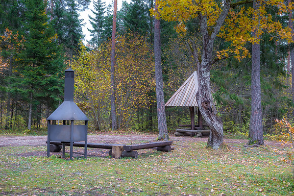
A campsite with several campfire sites, located next to Varbola Castle, yet still relatively compact.
The camping area is perfect for a family holiday, as the adjacent Varbola Stronghold offers endless exploration and joy of discovery for visitors of all ages.
Sights
Varbola stronghold
Amenities
2 open fire places with grill rests, 2 covered fire places, water supply (bore well), 4 covered tables-benches, benches, waste bins, lean-to shelter, dry toilet, information board.
Water
Well
Parking
Parking spaces for 6 cars.
Additional information
Before going on a nature walk please read the rules of conduct


By clicking on the map it will open the map application larger in a new window.
Long-Lat WGS 84
Latitude: 59.041129
Longitude: 24.506936
L-EST 97x: 529099.9
L-EST 97y: 6544807