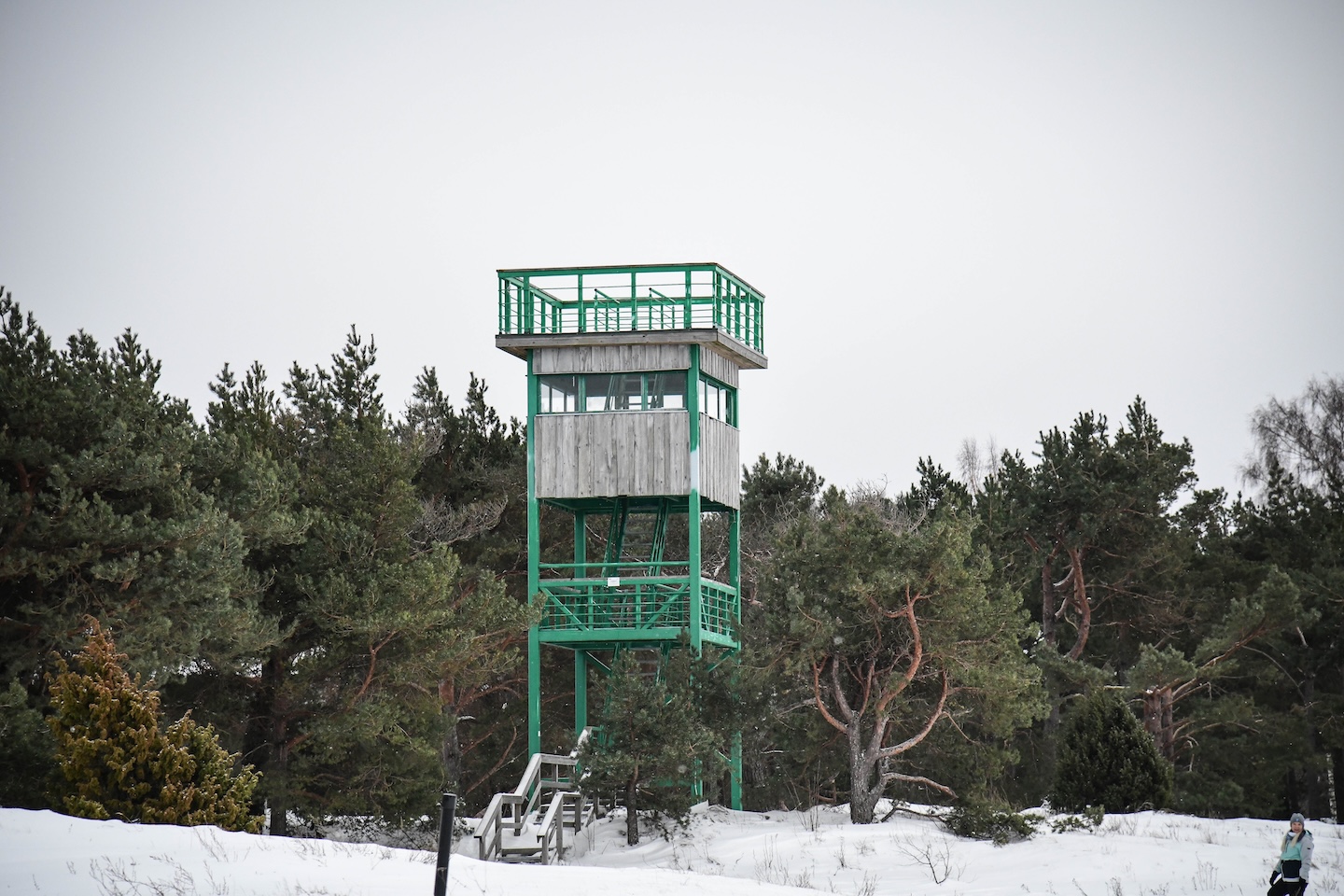
The observation tower at the Kabli Bird Station is a place where migration becomes visible and time slows down.
The observation tower is located in Kaabli Village, Pärnu County, in the heart of the Kaabli Nature Reserve. Built on the dunes, the observation tower has been used to support visual observations of birds since 1997. It offers magnificent views of the coastal and dune landscapes and, during the spring and autumn migrations, it provides an opportunity to observe the journey of birds moving along the Gulf of Riga migration corridor.
Located next to the Kabli Nature Study Trail, the observation tower invites hikers on the trail to stop, look, and take in the beauty of the surrounding nature.
The tower is open 24 hours a day, offering both short and long opportunities to enjoy nature.
Sightseeing
Diverse landscapes and precious habitats, Kabli Bird Station, and the beautiful coastal sea.
Equipment
Information stands located along the trail, as well as an information stand and an observation tower near the Kabli Bird Station. There is also a collection of nest boxes along the trail.
Parking options
Space for 10 cars or 2 buses in front of the visitor centre.
There are two disabled toilets along the trail. Due to the unevenness of the gravel covered section of the trail, it is recommended that persons with reduced mobility be accompanied by an escort. The trail is not accessible by wheelchair in winter.
Contact
Telephone: +372 505 8242
E-mail: info.kabli@rmk.ee
Object type: observation tower
Location info
Location : Pärnu County, Pärnumaa Recreation Area
Kabli village, Häädemeeste municipality
Navigation instructions : Drive along the old Pärnu–Riga road towards Kabli. Turn right after crossing the Priivitsa stream, at the Orajõe forest district bus stop (sign to Kabli Visitor Centre). Follow the sign to Kabli Visitor Centre, where the study trail starts.
By clicking on the map it will open the map application larger in a new window.
Telephone:
+372 505 8242
E-mail:
info.kabli@rmk.ee
Object type:
observation tower
Location info
Location:
Pärnu County, Pärnumaa Recreation Area
Kabli village, Häädemeeste municipality
Navigation instructions:
Drive along the old Pärnu–Riga road towards Kabli. Turn right after crossing the Priivitsa stream, at the Orajõe forest district bus stop (sign to Kabli Visitor Centre). Follow the sign to Kabli Visitor Centre, where the study trail starts.
Valgejärve nature trail observation tower (distance from the parking lot 2.3 km)
Võimalused
Lääne County, Tallinn Recreation Area
Announcement!
The Agriculture and Food Board warns about the spread of avian influenza. Please stay away from dead birds outdoors and ensure that your pets do not come into contact with them. NB! If you find a dead bird, do not touch it or move it anywhere! Please report it to the Agriculture and Food Board by calling 605 4767 or 1247.
The Valgejärve nature study trail has an observation tower renovated in 2024, from which it is possible to admire the view of the diverse bog and forest landscape.
Piirsalu village, Lääne-Nigula municipality, Lääne county
Navigation instructions : Drive on the Ääsmäe-Haapsalu highway towards Haapsalu and turn right at the 29th kilometer following the sign. Continue driving for 5 km following the signs to Lake Järveotsa, where the parking lot of the Valgejärve nature study trail is located. From the parking lot, signs point to the nature trail, and if you walk along the nature trail, the observation tower is about 2.3 km from the parking lot.
By clicking on the map it will open the map application larger in a new window.
Telephone:
+372 676 7842
E-mail:
info.viimsi@rmk.ee
Object type:
observation tower
Location info
Location:
Lääne County, Tallinn Recreation Area
Piirsalu village, Lääne-Nigula municipality, Lääne county
Navigation instructions:
Drive on the Ääsmäe-Haapsalu highway towards Haapsalu and turn right at the 29th kilometer following the sign. Continue driving for 5 km following the signs to Lake Järveotsa, where the parking lot of the Valgejärve nature study trail is located. From the parking lot, signs point to the nature trail, and if you walk along the nature trail, the observation tower is about 2.3 km from the parking lot.
VõimalusedHiking trail/Hiking OptionsCampingCovered fireplaceMaintenance during summer
Ida-Viru County, Peipsi põhjaranniku Recreation Area
Announcement!
The Agriculture and Food Board warns about the spread of avian influenza. Please stay away from dead birds outdoors and ensure that your pets do not come into contact with them. NB! If you find a dead bird, do not touch it or move it anywhere! Please report it to the Agriculture and Food Board by calling 605 4767 or 1247.
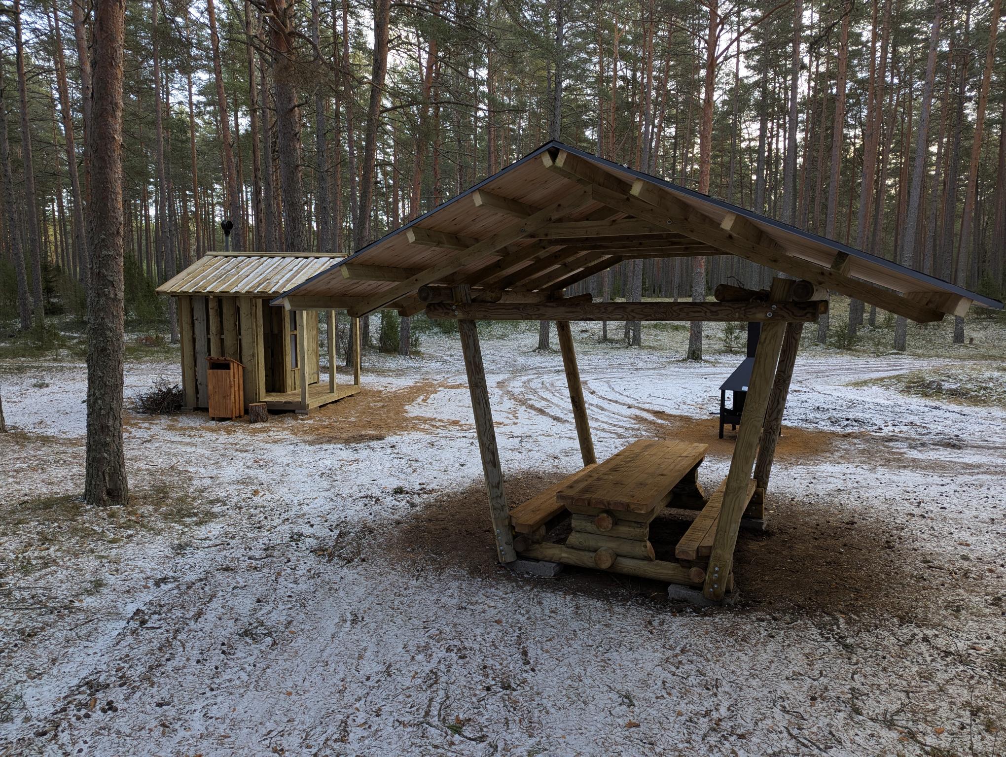
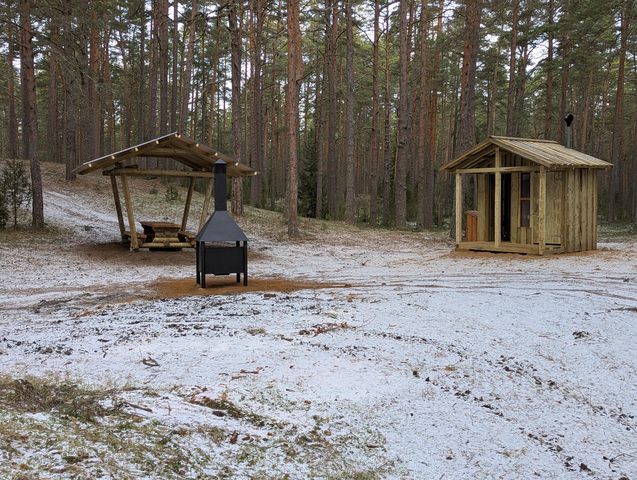
The Narva-Jõesuu campfire site is located on the RMK Hiking Route, at the 17th kilometre of the Mummassaare–Narva extension of the trail, which connects the Penijõe-Aegviidu-Kauksi branch with Narva-Jõesuu and Narva. In this way, Estonia’s easternmost cities are also linked to the RMK Hiking Route. The new section of trail has a length of 36 kilometres. The wooded area here is known as Auga Park Forest, the southwestern part of which is Auga Forest, and was most likely named after the locality of Auga. It has been a well-known swimming spot and summer destination in Narva-Jõesuu. The forest behind the town is ideal for recreation and walking, is easily accessible and, at the same time, as diverse as possible while offering exhilarating experiences. A majority of the area is the habitat type for lingonberries, on which pine stands can be found growing. A few spruce stands can be found only in the northwestern part of the area. The pine stands are up to 220 years old. There is hardly any undergrowth; although, in the more fertile areas, there are spruces, junipers, and rowans. This is a community forest, where forest management takes place under conditions agreed upon by the community and the local government. In the middle of the area are protected key habitats.
Sights
Auga Forest, sand dunes, Narva-Jõesuu resort town, beach
Amenities
Covered fire pit, covered table-bench, dry toilet, and information board
In 1943, the Germans started building fortified defence lines in case of a retreat. While Panther, the main Narva defence line, was situated on the shoreline of Narva River, then Tannenberg Line, built from Mummassaare across the Sinimägi Hills to Vaivara, was meant as a backup line. The defence line was built by the German army construction company Organisation Todt. The name Tannenberg was taken from a battleground in Poland, where the Germans definitively beat the Tsar’s army during World War I. The Tannenberg defence line started in Mummassaare almost right by the shore and ran across the highway to Lastekodumäe Hill. From there on it ran across Sirgala, Puhatu and Gorodenka marsh up to Narva River and Lake Peipus. The ditches were furnished with logs and poles. In the lower places, where full profile ditches were not an option, dirt embankments and stakewalls or palisades were built. Mines, tanks, and wire barriers were set in front of the line. The line was also supported by a railway network in the Vasknarva-Kurtna-Vaivara region. The key elements of the line were the surrounding Sinimägi Hills. The war action reached the Tannenberg Line in the evening of 26 July 1944 and lasted until mid-September.Today, the defence line is visible up until the Sinimäe junction.
In 1926, Vaivara Manor was readjusted into an orphanage under the direction of the famous Tallinn building company Treubeck. The renovated manor building had 58 high and airy rooms. The upper floor was intended for girl’s rooms and the orphanage director’s office and living quarters, the ground floor for boy’s rooms and educators’ living quarters. The orphanage that was opened in such a grand building impressed the media back then, and it was called the first perfect orphanage in Estonia. The reconstruction was finally completed in 1932. Vaivara orphanage had it’s own farmstead with 24,56 ha of arable land, 34 ha of haying land and 28 ha of pasture. In 1934, the farm had 6 horses, 18 cows and 40 chickens. Pigs were also kept. The farm also had a few beehives and a greenhouse where in addition to vegetables and flowers grew 8 vinetrees. All the farmwork was done by the orphans. During summers, only children of weaker health remained in the orphanage while others were give into foster homes or worked as shepards in the neighborhing farms. In August 1941, the children were evacuated from the orphanage to the Uralic Mountains and the retreating Russian army burned down the castle. One can read about the fates of the evacuated children in Russia from Ene Hion’s books Saatust ei valita (1990) and Valged varesed (2014).
In 1950, the archeological excavations were lead by archeology professor Harry Moora. A piece of textile was found from one of the barrows from a Vote woman buried in the end of the 13th or the beginning of the 14th century. The significance of the find became evident 30 years later, when archaeologist Jüri Peets started registering the textiles. It turned out to be a piece of glove knit with needles. It is the oldest textile fragment knit with needles in the whole Eastern and Northern Europe. The skill of knitting with needles in the Baltics was thus far considered to have been acquired in the 17th century. However, with the Jõuga glove finding, it can be dated back to the start of 14th century—300 years earlier. The custom of putting gloves on the dead was probably known only to the Finnic peoples, there are no such reports from other ethnic regions.
Despite its favourable conditions, the northern shore of Lake Peipus as a holiday spot was discovered quite late. In 1961, the Kauksi tourist centre was decided to be built and the first 25 tent-houses were put up on the beach. In 1962, the construction of a type-project summer café began. The café was completed in May 1965. Kauksi tourist centre was well known all over the Soviet Union. In 1966, the centre welcomed 150 hikers with vouchers and 30 hikers without them. They were ensured lodging in a tent and catering. In the evenings, the guests were shown movies and cultural events were organised. There were volleyball and badminton courts, one could play table tennis, korona and billiards. Boats and pedalos were available for joyrides. There were hiking lessons, trips to nearby places, and boat trips on Peipus. The tourist centre even had its own library, post office, long distance telephone booth, and a doctor. Besides the visitors of the tourist centre, many hikers, vacationers, and tourists from Estonia and abroad stopped by Kauksi. Many summerhouses for different organisations and also summerhouse cooperatives were built on the northern coast of Lake Peipus. There was a plan for a pioneer camp for 800 children, but this was never built. In 1991-1992, small camping huts were built on Kauksi beach. Nowadays they are called Kauksi Resort Village.
More than half of the forest area in Estonia belongs to the state. According to the Estonian Land Reform Act of 1919, the forests of nationalised manors were not to be distributed. As manor forests accounted for nearly 70% of the forests at that time, it led to the predominance of state forestry in Estonia. The State Forest Management Centre (RMK) is the manager and the keeper of the forests and other diverse natural communities that belong to the Estonian state. RMK takes care of 45% of Estonia’s forest land and of about 30% of Estonia’s total land area. Information on Estonian forest resources is collected by taking forest inventory. In 2007, 816,000 hectares of state forest were registered by RMK. After a few years, RMK started to enter the lands that were still owned by the state into the land cadastre, and the state forest began to grow. In 2014, RMK’s forest area exceeded 900,000 ha and continued to grow by nearly 35,000 ha per year. On September 30, 2017, a newly described 120-year-old mixed spruce forest near Vergi was entered into the RMK database. The area of the state forest thus exceeded a million hectares.
Of the artificial landforms of North-Eastern Estonia, the Kiviõli hills have always garnered the most attention in tourist literature and reference books. The solid waste of oil shale pyrolysis, semi-coke, was first disposed to the old Ash Hill in 1922 and to the new Ash Hill in 1951. Semi-coke is composed of limestone, calcium compunds formed by heating the limestone and unused organic material. In 1938, Osvald Tooming wrote in Virumaa Teataja: ‘Ash hill!!! The crown jewel of Kiviõli that can be seen from tens of kilometres away, inspiring wonder and surprise even in train passengers rushing by. The 70-metre coke heap has been named the second Munamägi, and it gets higher every day.’ The semi-coke was first transported by horses, later by cable cars to the crest of the hill, where it was emptied and distributed by a transporter. As the hill grew, the semi-coke transported to the top started being rinsed down the hill with water. This resulted in the formation of a spoil tip with quite an extensive, gentle foot and a narrow, steep-sided and few-hundred-meter-long even crest in the northern part of Kiviõli. The new and old Kiviõli hills are respectively 116 m and 96 m high. The old semi-coke hill was closed in 1975 and the new one in the 1990s. The semi-coke is now stratified to the foot of the new hill. The old semi-coke hill was closed in 1975 and the new hill in the 1990’s. Nowadays technology has changed and semi-coke is no longer piled into sharp-cut hills.
In 1960, the ESSR People’s Economy Council determined the location of a new quarry. For some time, people continued to live in the villages that were appointed to be removed. Life went on more or less the same for almost ten years until the quarry started working in 1974 and the roads were closed, water was cut off, and the detonations made life unsafe. With the establishment of the quarry the villages of Aidu-Liiva, Aidu-Nõmme and Aidu were destroyed. A third of the residents of the Maidla village council were forced to leave their homes behind and after ten years, nothing but names remained of the villages. The long time village school teacher Kustas Kraus was one of the last to leave his home. On the basis of his journals Vaida Pungas writes:
“When the iron giant was already rattling on the sister villages and devaouring households. When the school house was fell in the hands of vandals and was torn into pieces. When the powerful detonations tore abart the backbones of the last houses and the stone shingles thrown apart by the explosions poked holes in the roofs. When the situation became so dangeours that it was impossible to stay on in Aidu, only then did the old school teacher who was spending his summers as a free man in his family home take from the wall niche a noteboard and scribbled an addition to other important events of the 20th century – the date of the ultimate ruin of Aidu village anno 1977”
Oil shale was mined from the quarry for almost 40 years. The mining stopped in 2012.